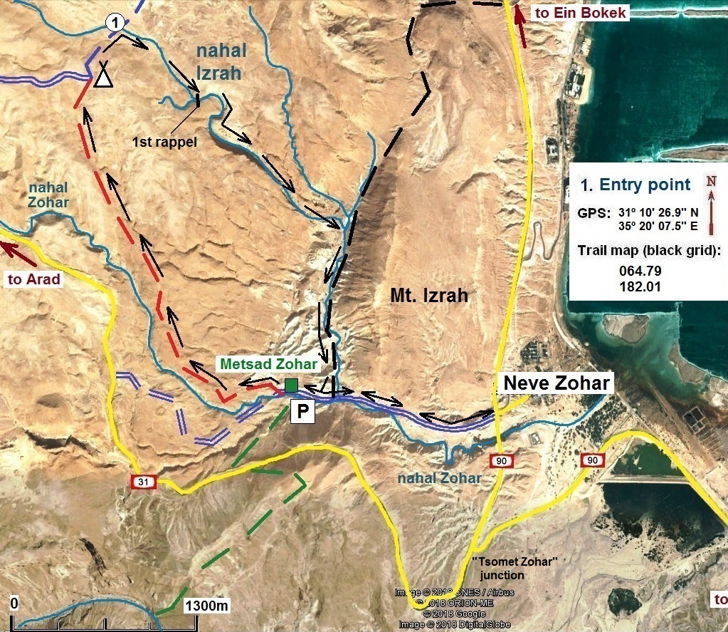
Nahal Izrah
Judean Desert
Rappelling from the
last dry fall
The route type:
Rappelling trip. All dry falls of this route can be easily bypassed so
you can either to rappel or just to hike down the canyon.
The canyon is dry all the year round but be wary about floods during winter rains.
Only one rappelling
station equipped with bolts. *
So, bring you own equipment to build
the stations.
Getting there:
Drive to Neve Zohar community settlement which is located on the highway
90, 1km to north of the "Tsomet Zohar" junction (junction of Highway 90 and Highway 31). A dirt road marked with blue
marks branches from the Highway 90 just opposite to the entrance to Neve Zohar settlement and leads
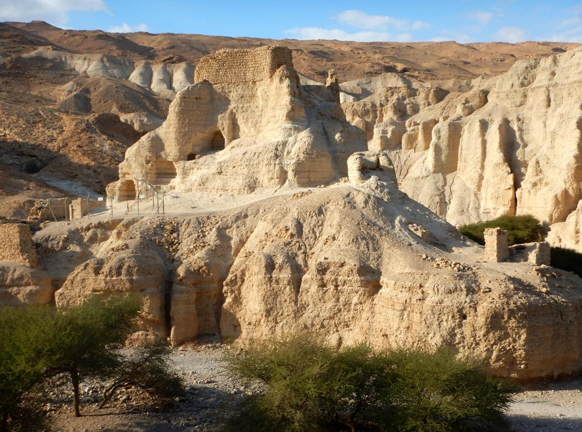
west to "Metsad Zohar"
- an ancient Roman fortress (which is pretty interesting and worth exploring
for a ten minutes).
Park your car at "Metsad Zohar"
and walk on the trail marked with red marks. The trail goes up gradually and
leads to the main plateau (height gain 380m).
Eventually, after 3.4km, the trail ends at a T-junction with a trail marked
with blue marks. Take the right-hand branch of the "blue" trail
(actually just continue straight). After 460m the trail crosses a very flat wadi which is nahal Izrah (point 1 on the map below). Leave the marked
trail and walk down the wadi for about 1.1km till the
first big dry fall ("1st rappel" on the map below).
|
|
|
|
|
|
|
|
|
Rappelling route description:
|
|
|
|
|
|
|
|
|

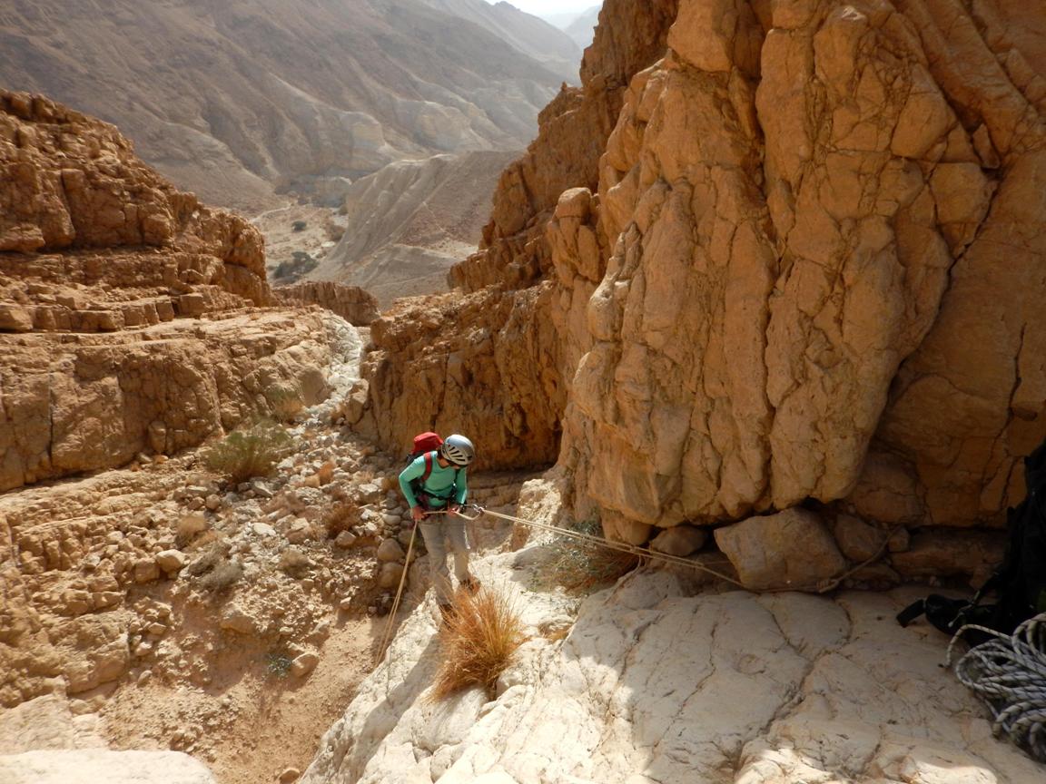
Approaching the nahal
Izrah rappelling route:
|
|
"Metsad Zohar" fortress |
|
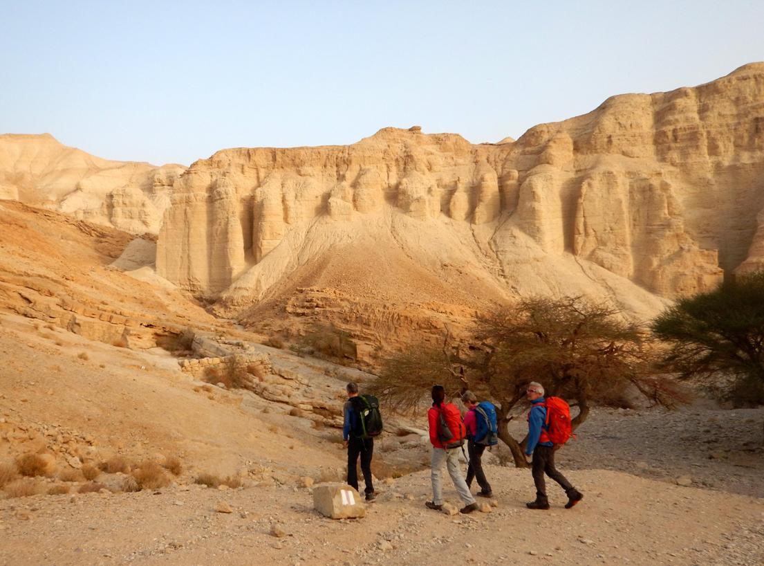
Starting to walk on the "red" trail |
|
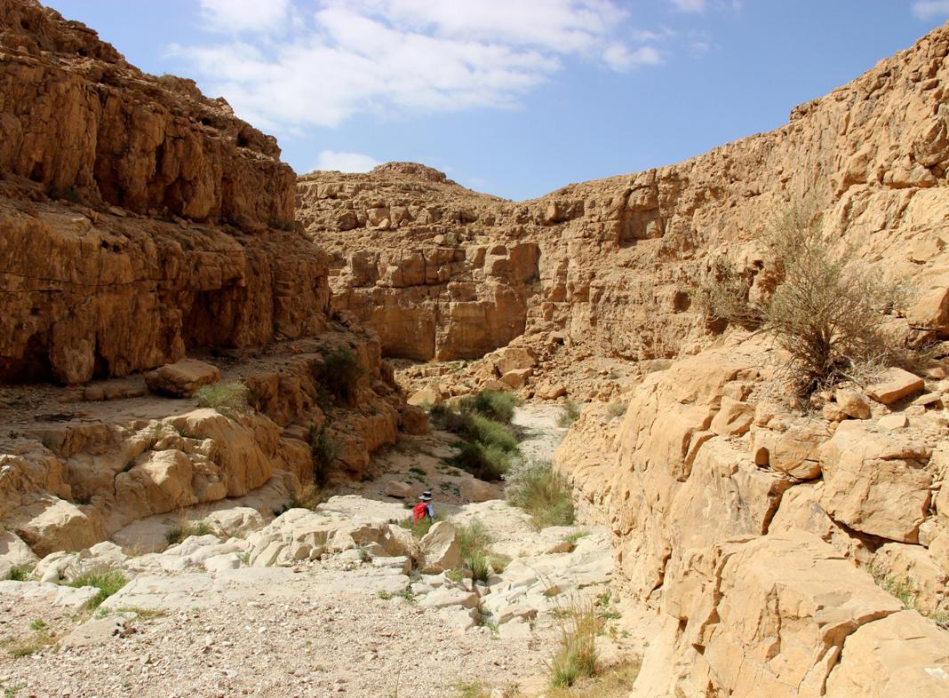
Walking down the wadi of nahal Izrah |
|
|
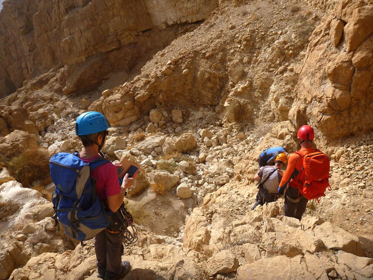
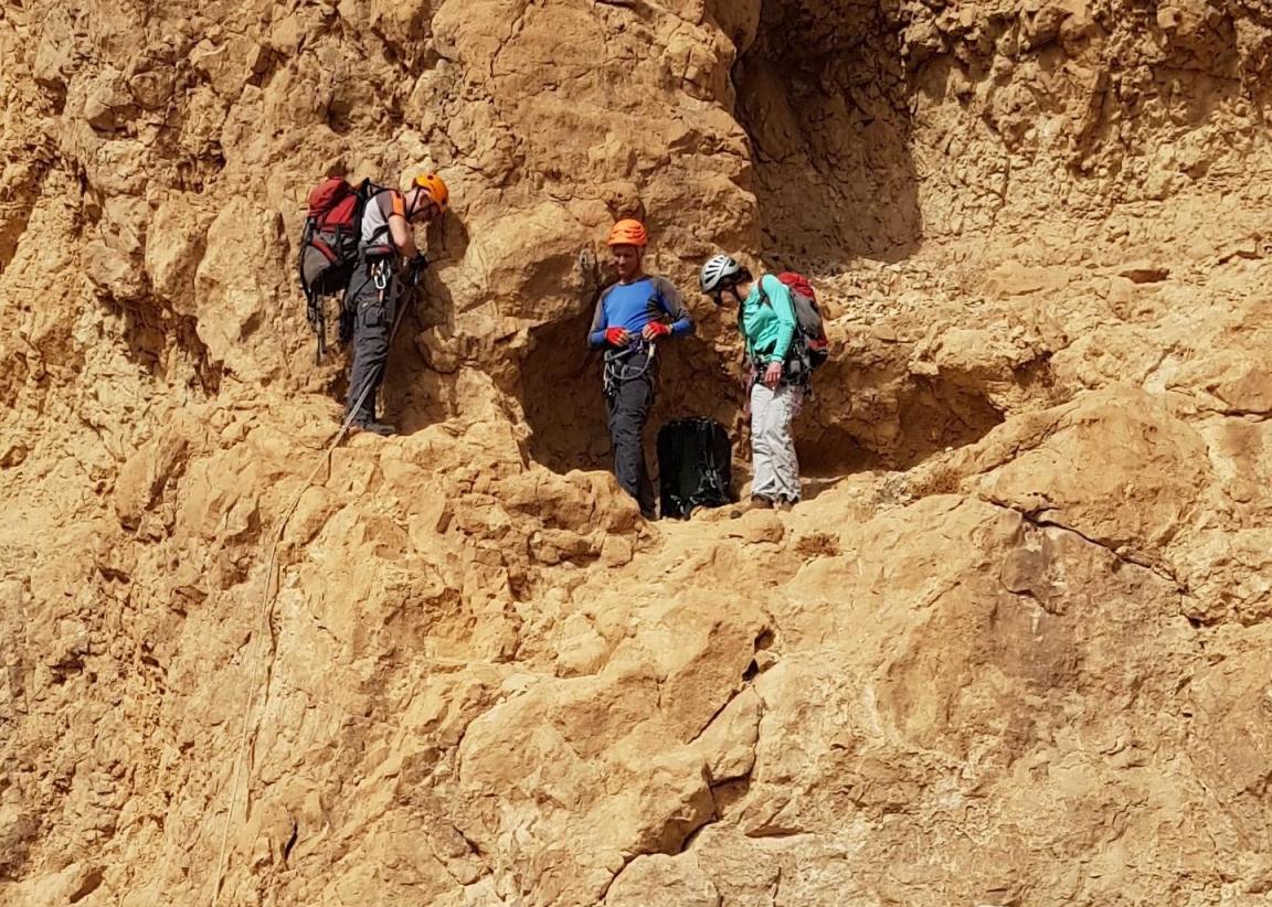
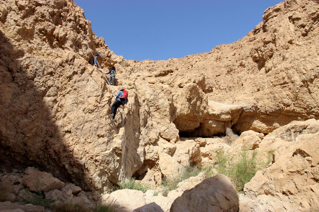
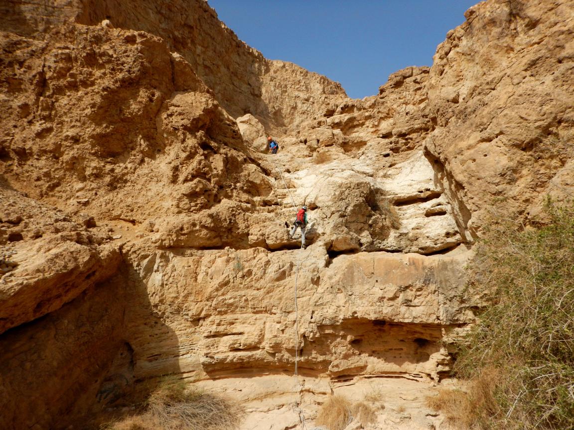
There are 6 obvious dry falls which
can be either abseiled or bypassed:
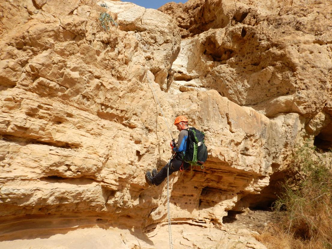
R1.
20m (ledges, then vertical). Can be bypassed on
the left (watch rujums)
The station can be establish
on rock bulges on the right side.
|
|
R1 rappelling station |
|
R1 rappelling station |
|
R1 rappel |
|
|

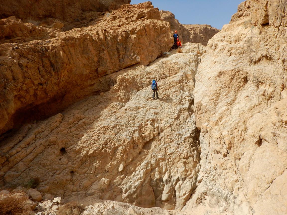
There is a relatively long walk (650m)
which brings you to the edge of the second dry fall.
While approaching the edge don't follow the main channel. Keep right and climb
down some rocky steps. The station is placed on the wall near the right end of
broad gap. One spit is visible from the approach but the glue-in bolt is placed
"behind the turn" and is invisible.
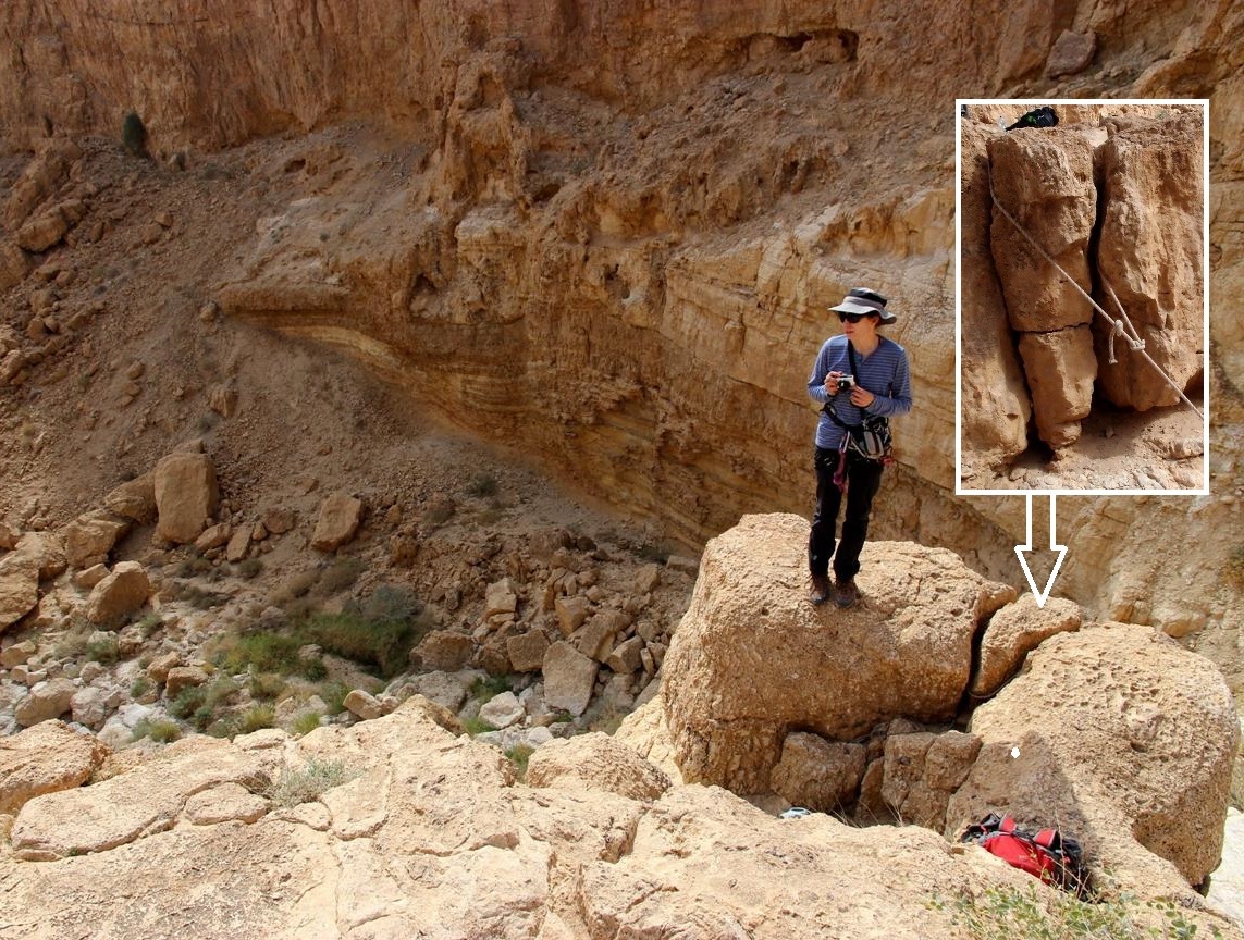
R2.
9m (vertical). Can be bypassed on the right
(narrow ledge which starts just from the rappelling station)
Anchor: one glue-in bolt and one spit on the right side. *
There is a natural through hole under the glue-in bolt as well.
|
|
Approach to the R2 rappelling station |
|
R2 rappelling station |
|
|
|
|
|
R2 rappelling station |
|
R2 rappel |
|
|
|
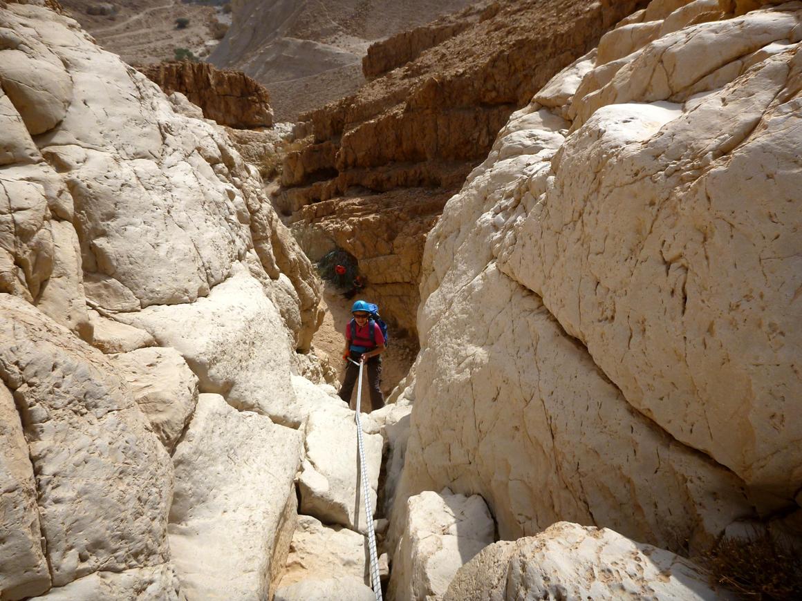
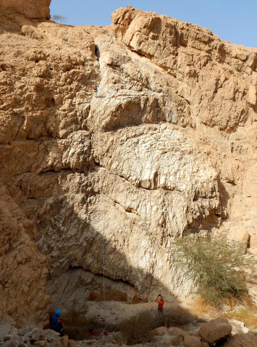
The next rappelling point is just couple
of tens meters down the canyon.
R3.
20m (sloped, then vertical with some short and easy overhang at the very
end). Can be bypassed on the left (watch rujums)
Anchor: A rope loop placed under a big boulder on the right
side of the main channel.*
|
|
R3 rappelling station |
|
R3 rappel |
|
R3 rappel |
|
|

About 100m further you come
to another dry fall:
R4.
19m (sloped). Can be bypassed on the right.
Anchor: A rope loop placed around stuck stones on the right
side of the main channel.*
|
|
R4 rappelling station |
|
R4 rappel |
|
|
|
The next dry fall follows
immediately after the previous one.
R5.
35m (sloped). Can be bypassed on the left (watch rujums)
Anchor: A rope loop placed on a stuck stone in the middle of
the channel about 3m from the edge. 2 to 5 meters farther you can find another
stuck stones and cracks to reinforce the station.*
|
|
R5 rappelling station |
|
R5 rappelling station |
|
R5 rappel |
|
|

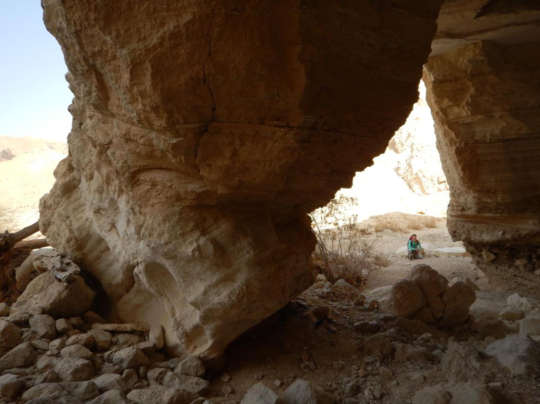
About 50m further you come to
the last dry fall:
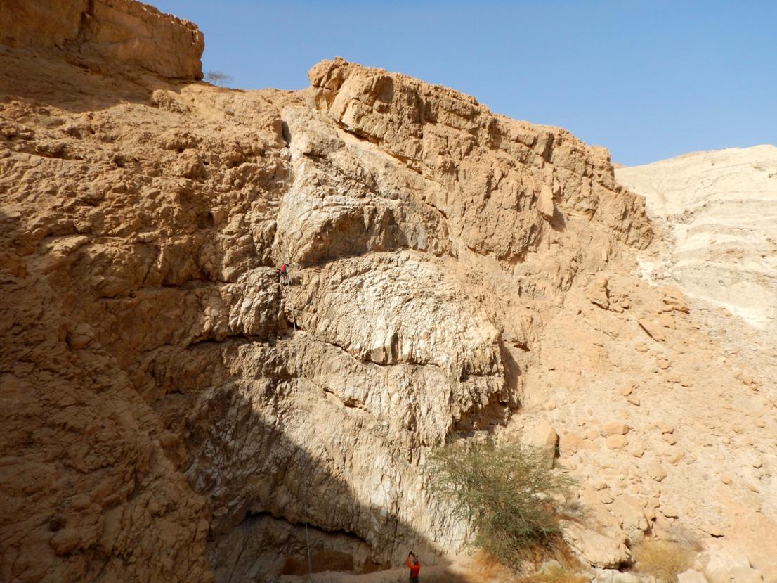
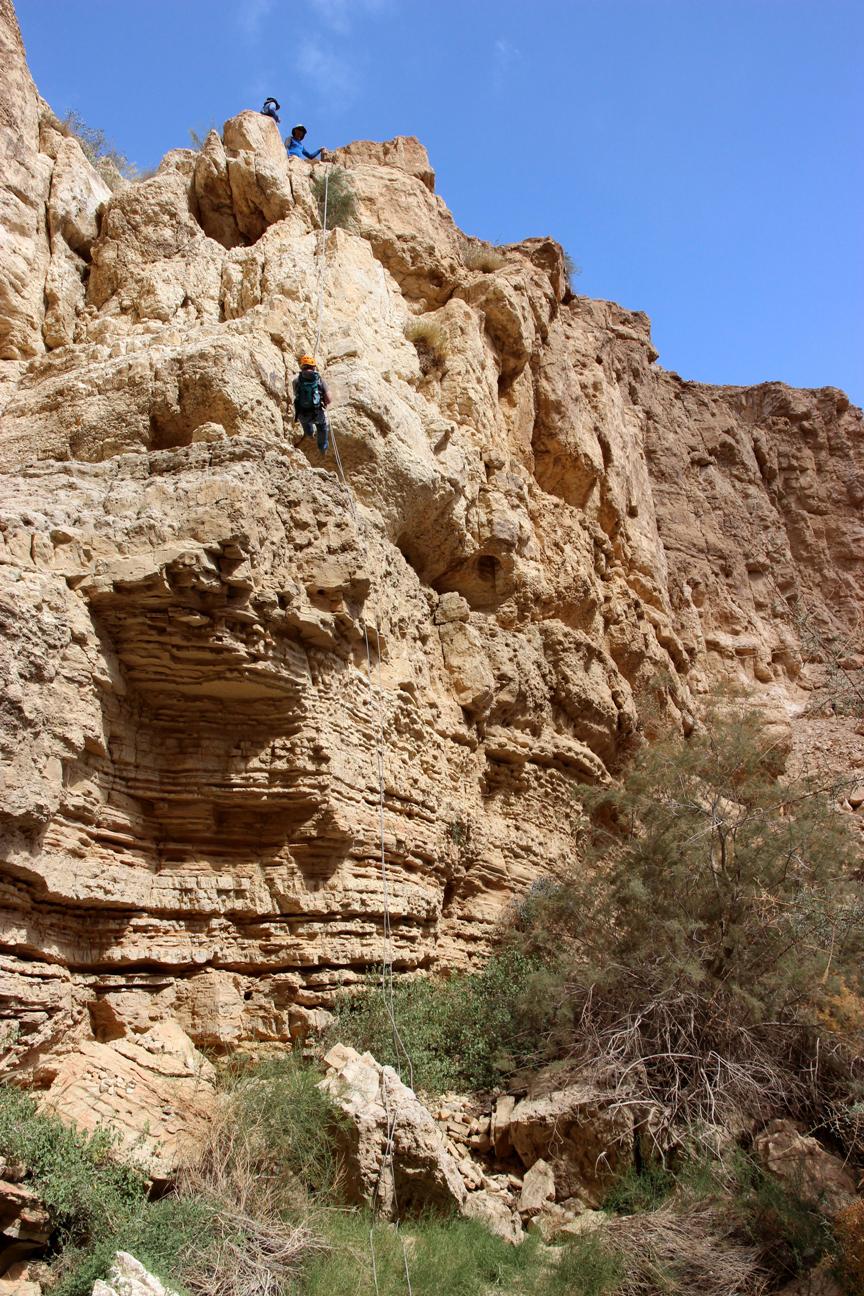
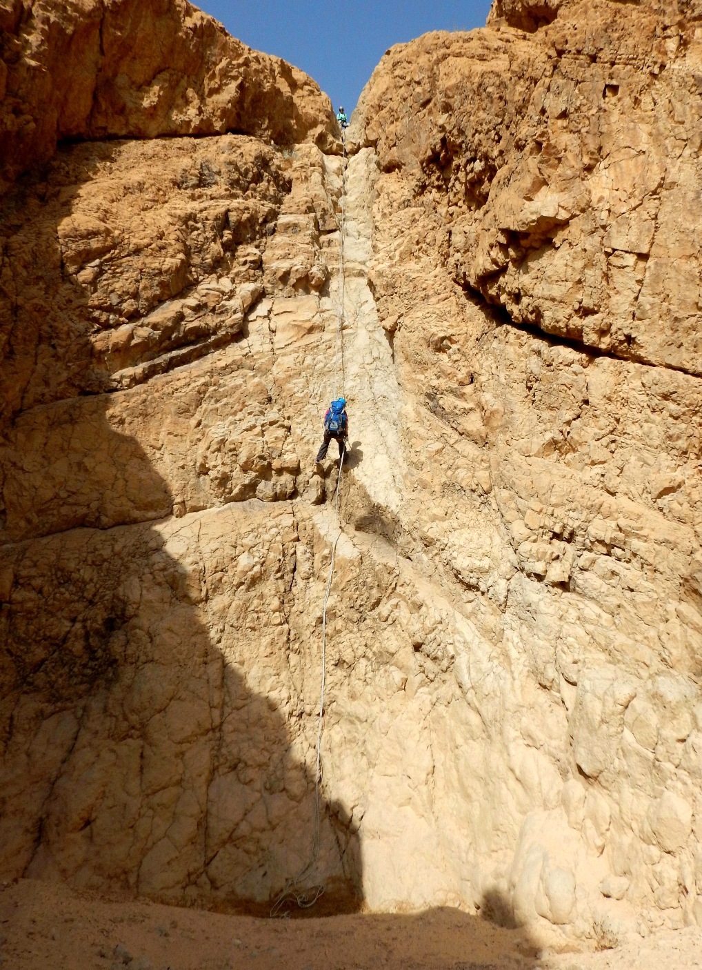
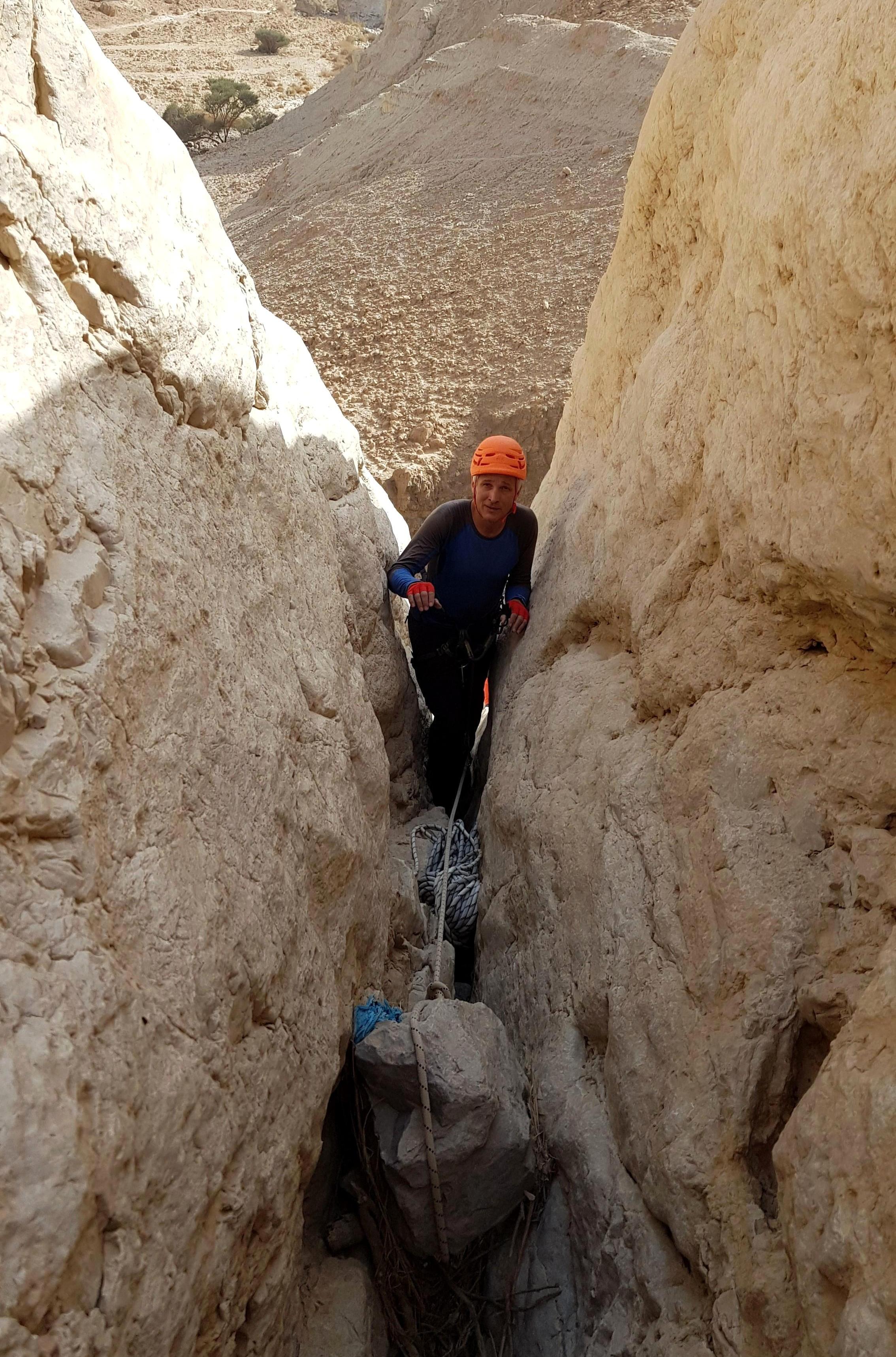
R6.
40-55m depending on the place where you will establish your rappelling station (sloped, then
vertical with some sloped ledge in the middle of the vertical descent). Can be bypassed on the right.
There is a long (about 15m) steep and
narrow crack with stuck stones which leads to the edge of the wall. If you plan
(as we did) to establish the station as close to the edge as possible you
should fix an auxiliary rope for the safety reason (15-17m long rope would be
enough). There is a some (honestly bad-looking...)
through hole under small stuck stones near the edge. (Must be backed up by means of the fixed rope coming
from above!) In such a case your rappel is 40m long only. *
|
|
Fixing a rope to approach to the edge |
|
R6 rappelling station (the "bad-looking through
hole") |
|
A view from the rappelling station |
|
|

|
|
R6 rappel |
|
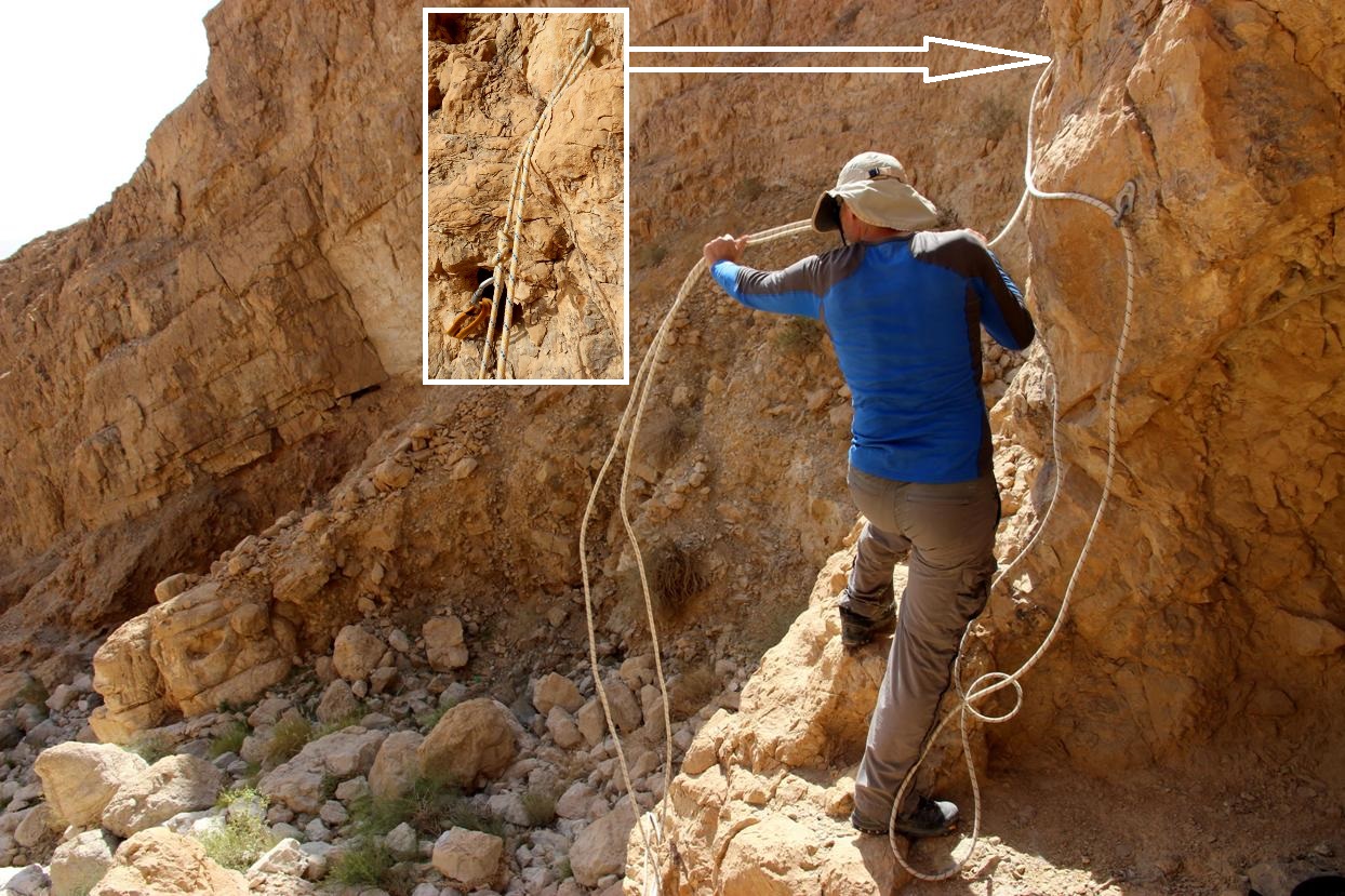
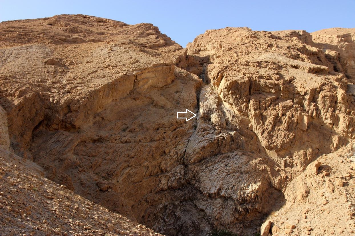
The last wall. The white arrow points to the R6
rappelling station |
|
|
|
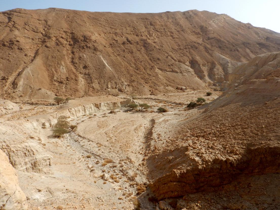
From below the wall continue straight
down for 150m to join the trail marked with black marks. Hike the trail to the
dirt road, leading back to "Metsad Zohar" (2km from the last rappel to the fortress).
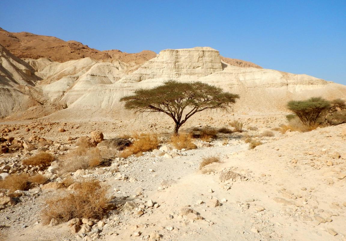
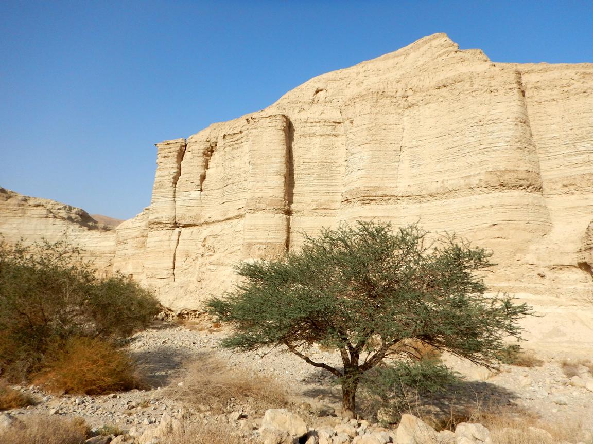
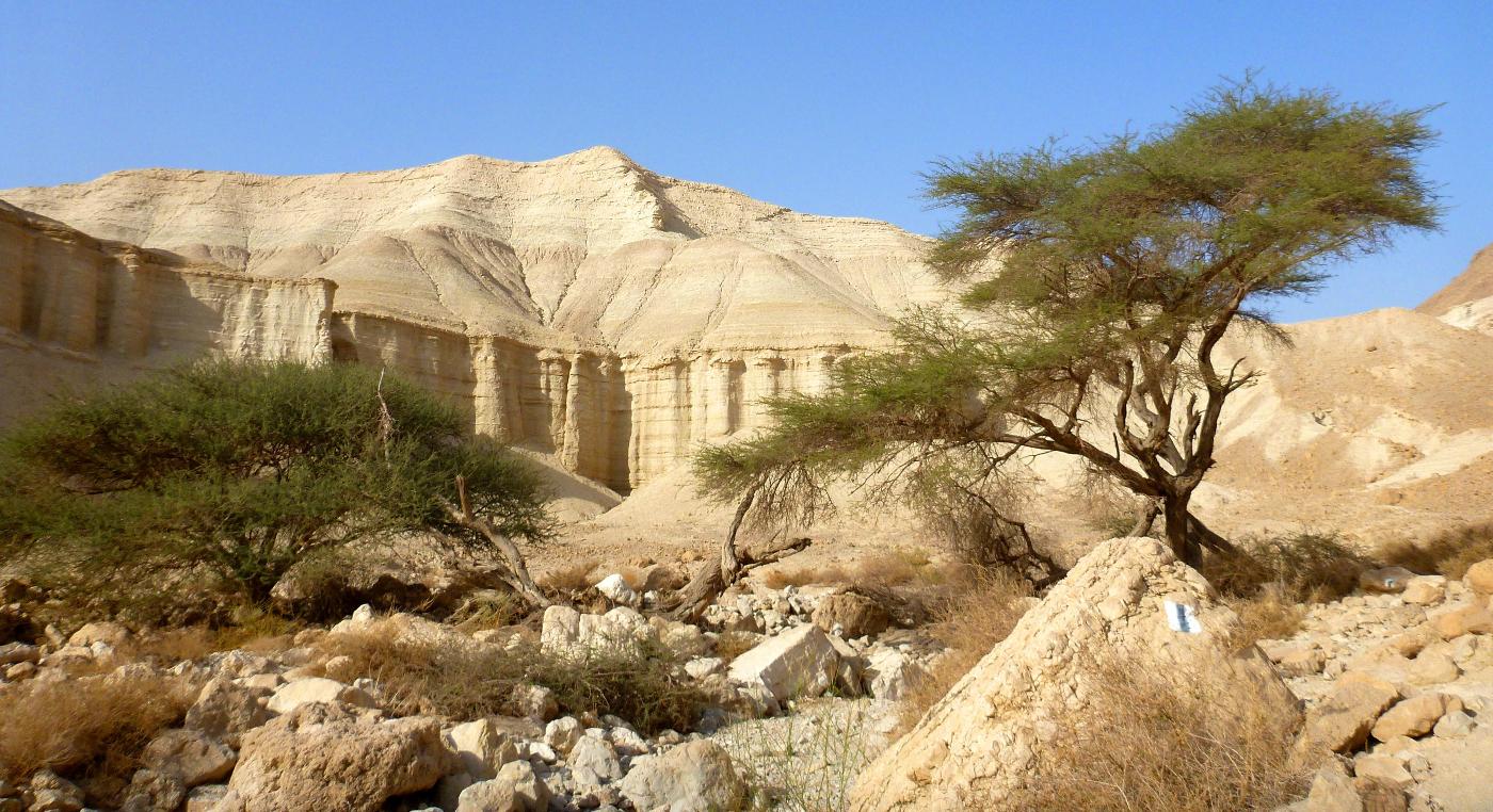
Actually this exit hike is the most impressive part of the trip in terms of
natural beauty. The landscape with all these white laminated towers and green
acacia trees is strikingly beautiful:
|
|
|
|
|
|
|
|
|
|
|
|
|
|
|
|
***** - The only one of its kind. A "must
do" trip!
****
- Very interesting, highly recommended!
***
- Pretty nice route.
**
- Inexpressive one.
*
- Do it if you have nothing to do...