Nahal Halamish
Judean Desert
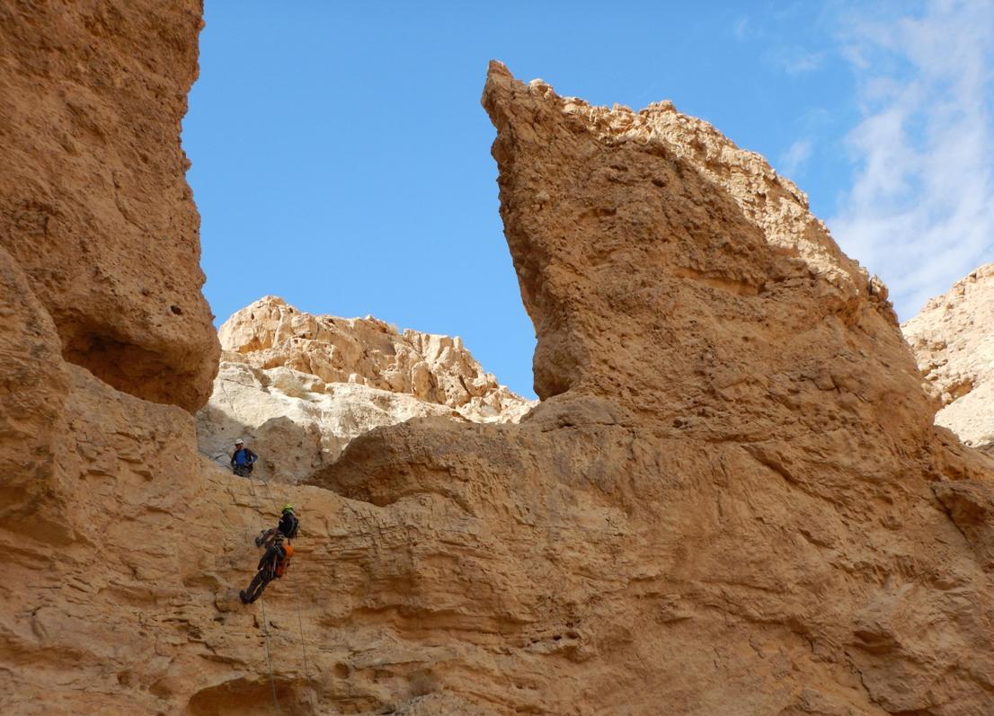
Rappelling from the
4th dry fall
The route type:
Rappelling trip.
The canyon is dry all the year round but be wary about floods during winter rains.
The rappelling
stations are equipped with bolts, most of which without hangers (“ears”). *
Bring you
own equipment (long rope loops, rings to pull the rope, “ears” etc.)
The route can be splitted
into three distinct sections with convenient entrance/exit points, so you can
do any version. The first section includes 1 rappel, the second – 2 rappels and
the third – one more rappel. This description refers to the longest possible
version which includes all 5 rappels.
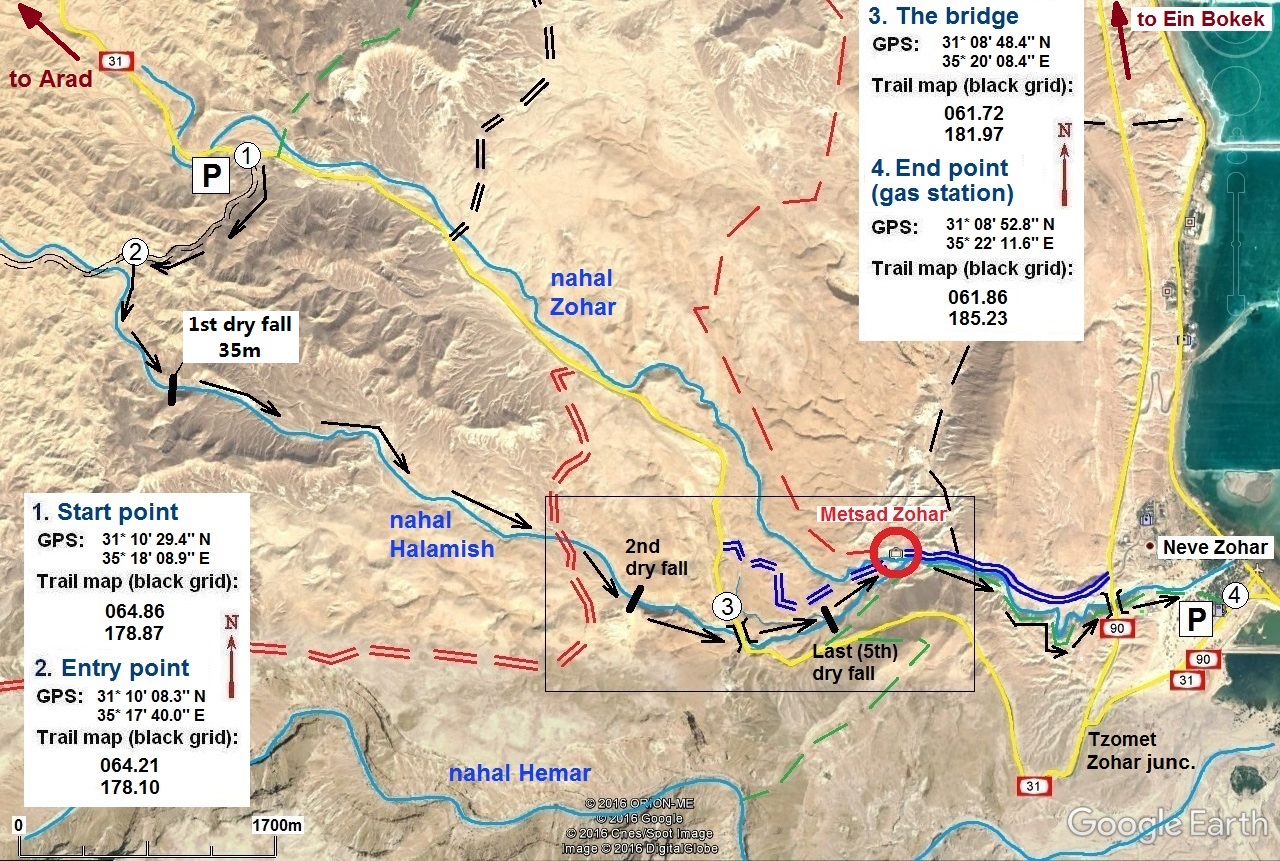
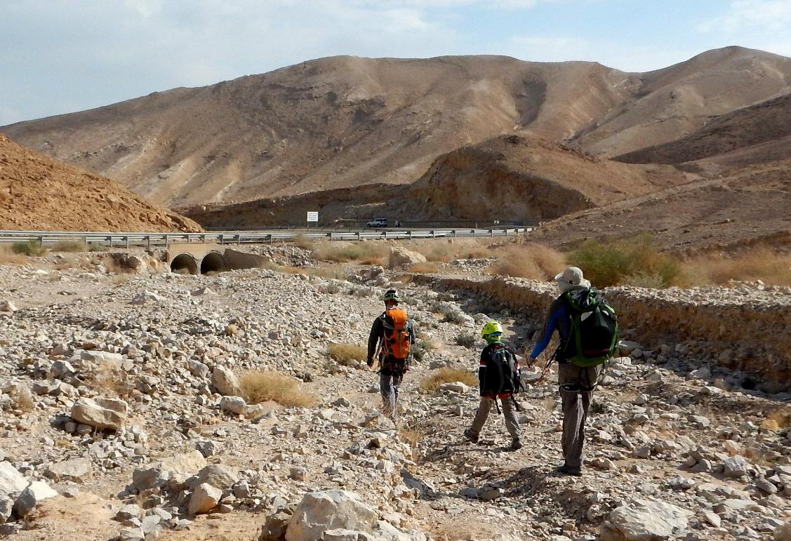
Getting there:
The end of the route is at “Delek” gas station (point 4) which is on the road 90, 1300m from Tzomet Zohar junction in the Eilat
direction and some vehicle should meet you here at the end of your trip.
Drive on the road 31 from Tzomet Zohar junction in
Walk on the dirt road for
(Worth mentioning that this dry fall can be easily bypassed on either side
as further down the wadi becomes very flat again. But
if you want to avoid this rappelling it is much more logic to start immediately
with the second part of the route, entering from road 31 via a dirt road marked
with red marks. It leads directly to the second dry fall)
|
|
|
|
|
|
|
|
|
Rappelling route description:
|
|
|
|
|
|
|
|
|
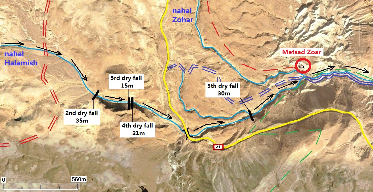
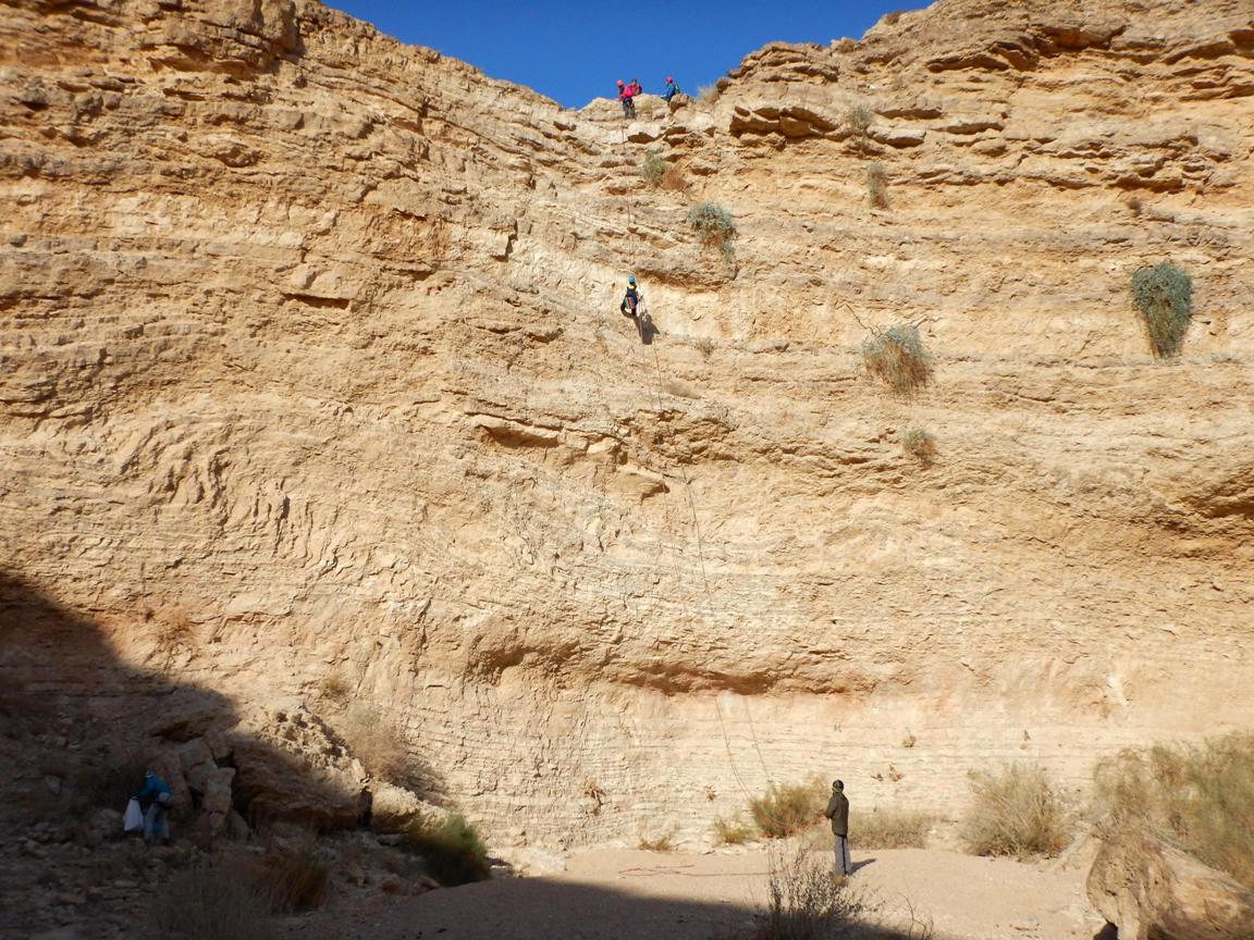
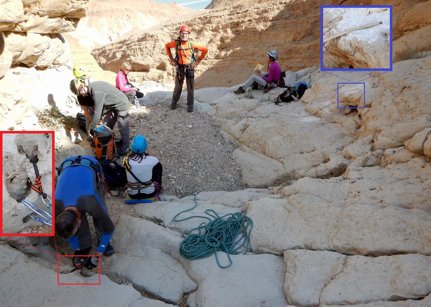
There are 5 dry falls to be abseiled:
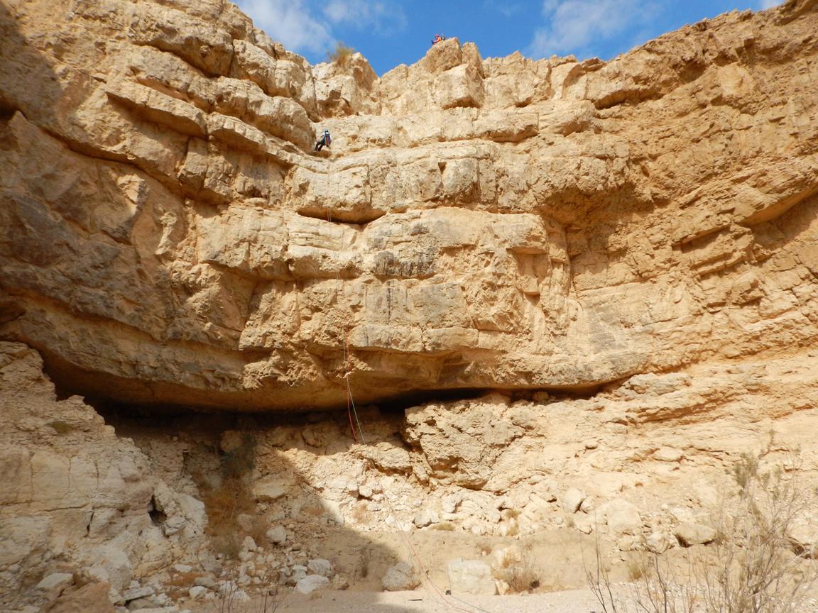
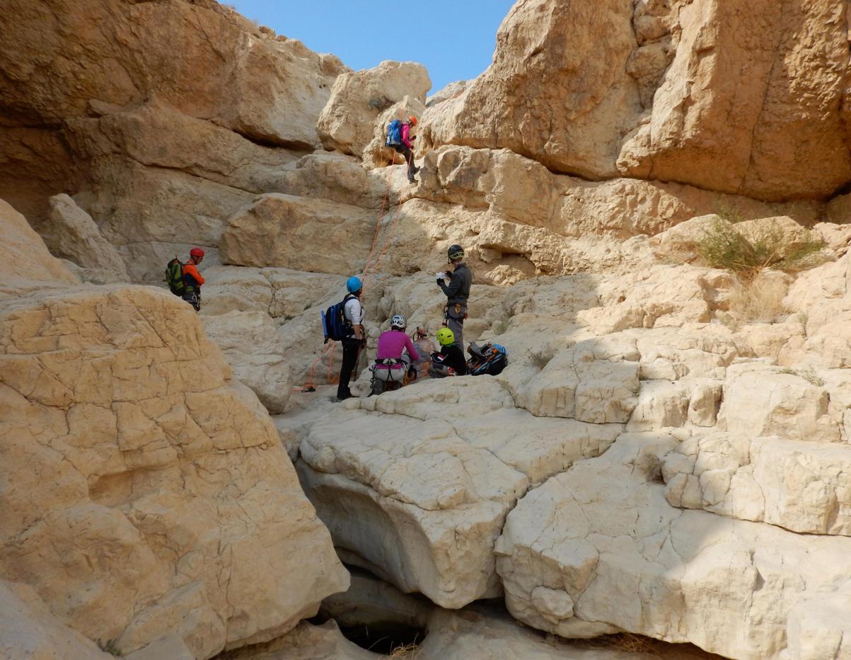
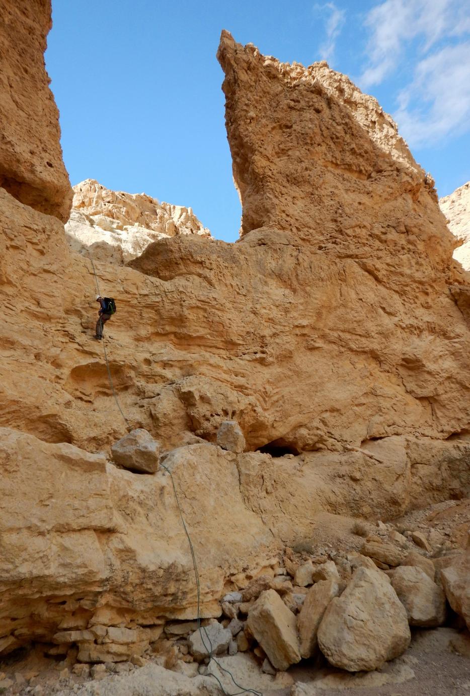
1. 35m (mostly vertical, last 8m - overhang).
At the moment, one “fully equipped” bolt
only (suitable to pull rope through) was found and many others without “ear”
are dotted everywhere around.*
We have used one of them (in a rather
improvised style…) to backup the station.
|
|
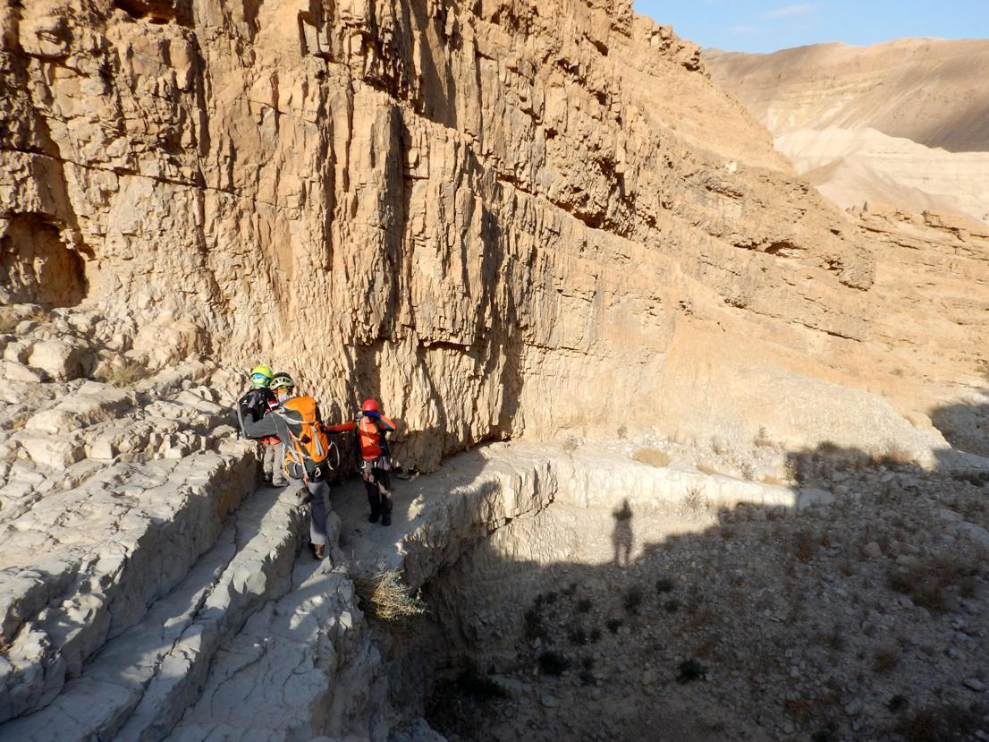
The 1st dry fall rappelling station. |
|
The 1st rappelling station |
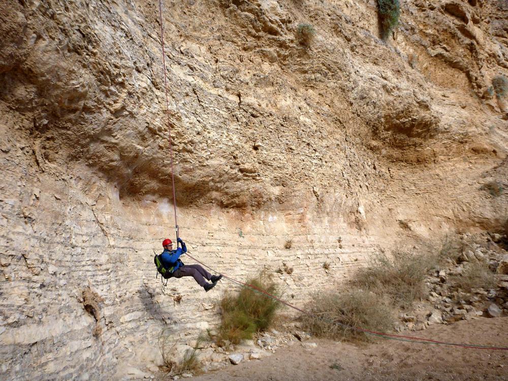
|
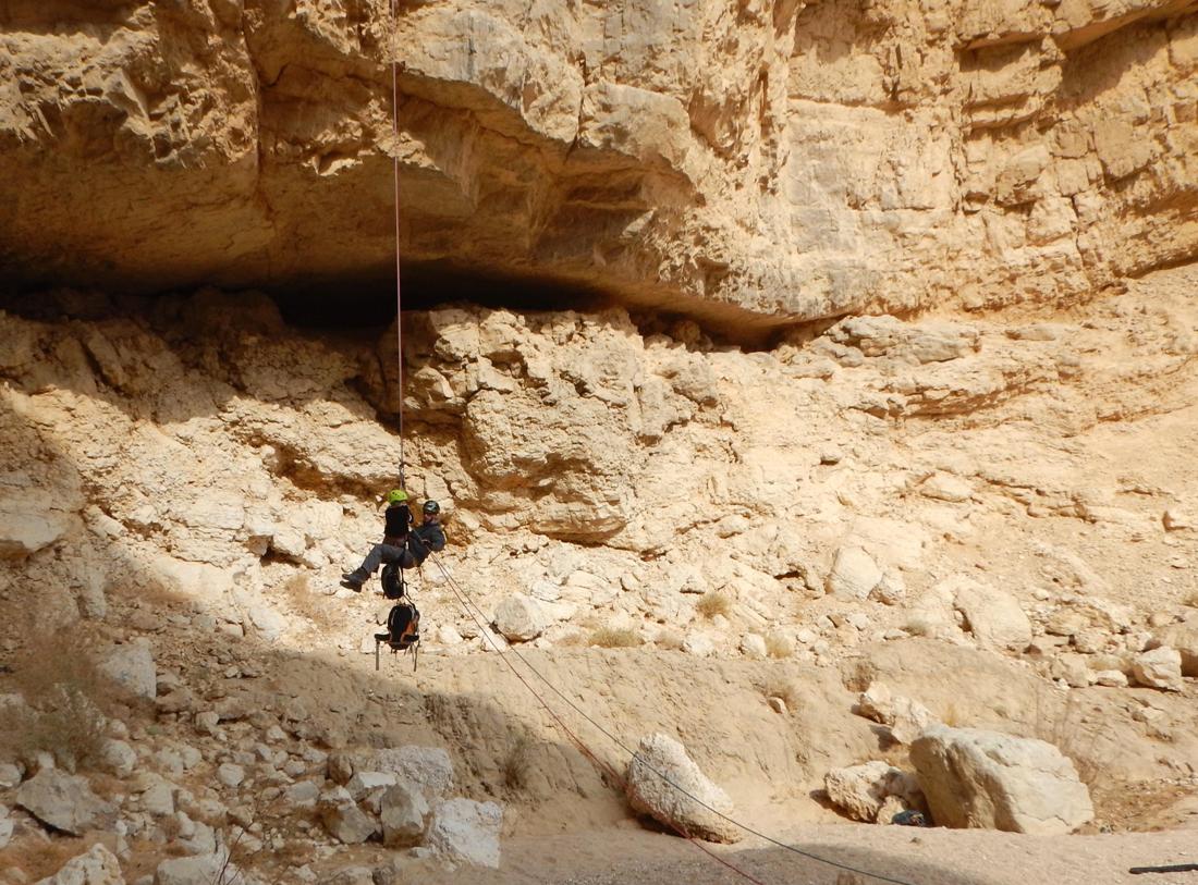
Rappelling from the 1st dry fall |
|
|
|
|
The 1st dry fall |
|
The 1st dry fall |
|
|
|
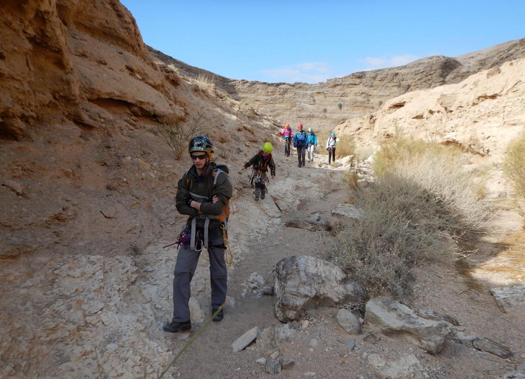
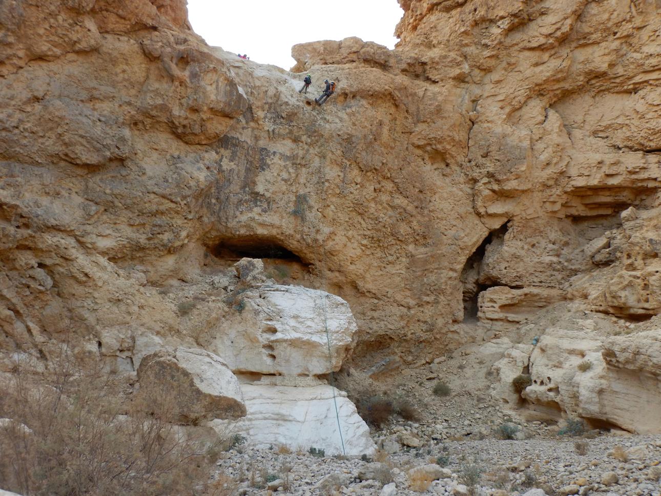
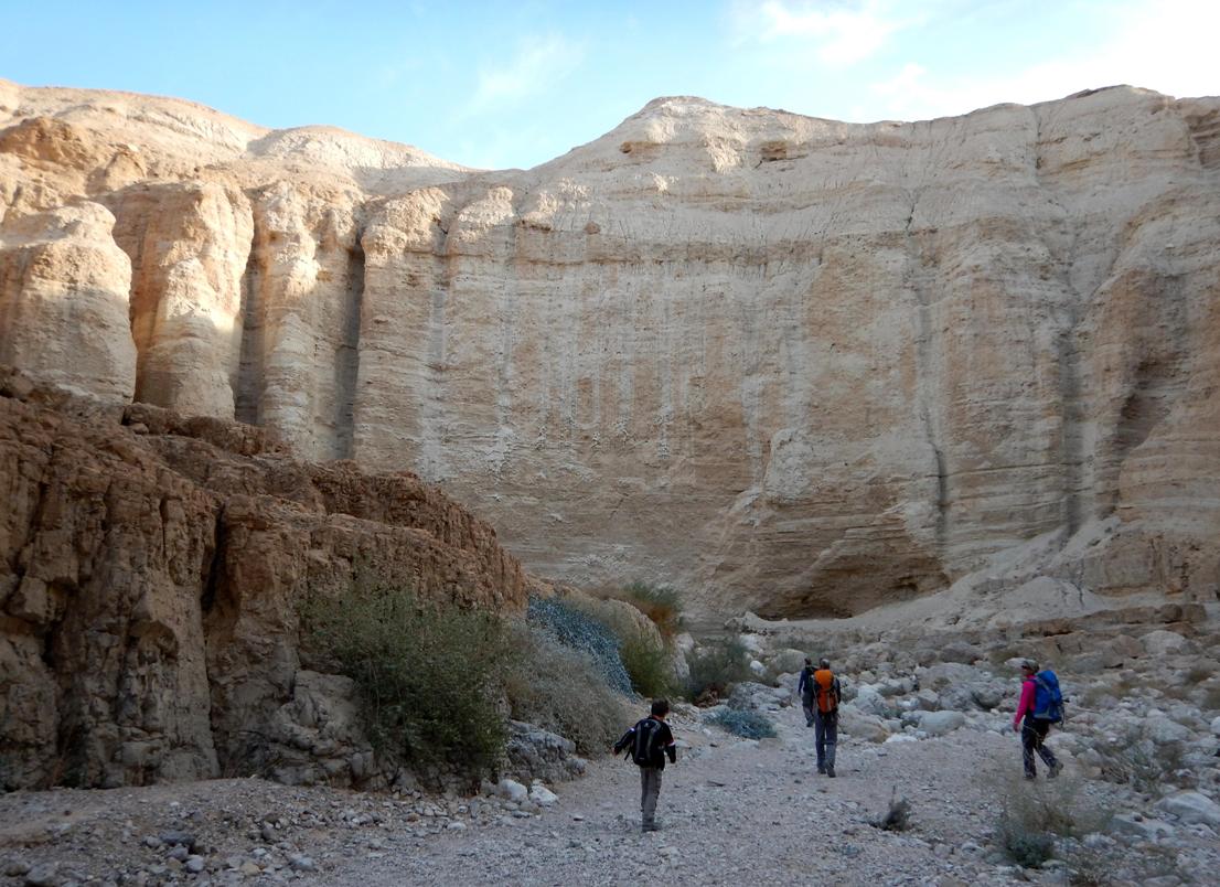
There is a long but easy walk through a
wide and flat wadi which brings you to the edge of
the second dry fall (
Walking to the 2nd dry fall:
|
|
|
|
|
|
|
|
2. 35m (vertical, then 20m overhanging).
At the moment, one bolt only (suitable to
pull rope through) was found on a big boulder. You need some long auxiliary rope
to backup you station. *
|
|
The 2nd dry fall rappelling station |
|
A view from the 2nd dry fall rappelling station |
|
|
|
|
|
The 2nd dry fall |
|
The 2nd dry fall |
|
|
|
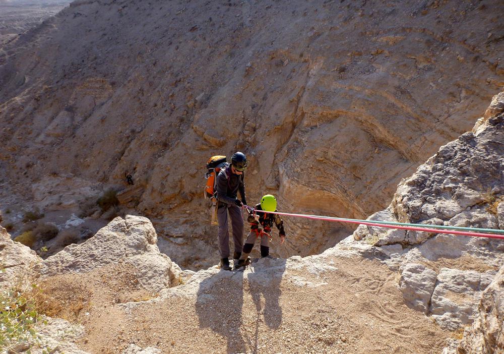
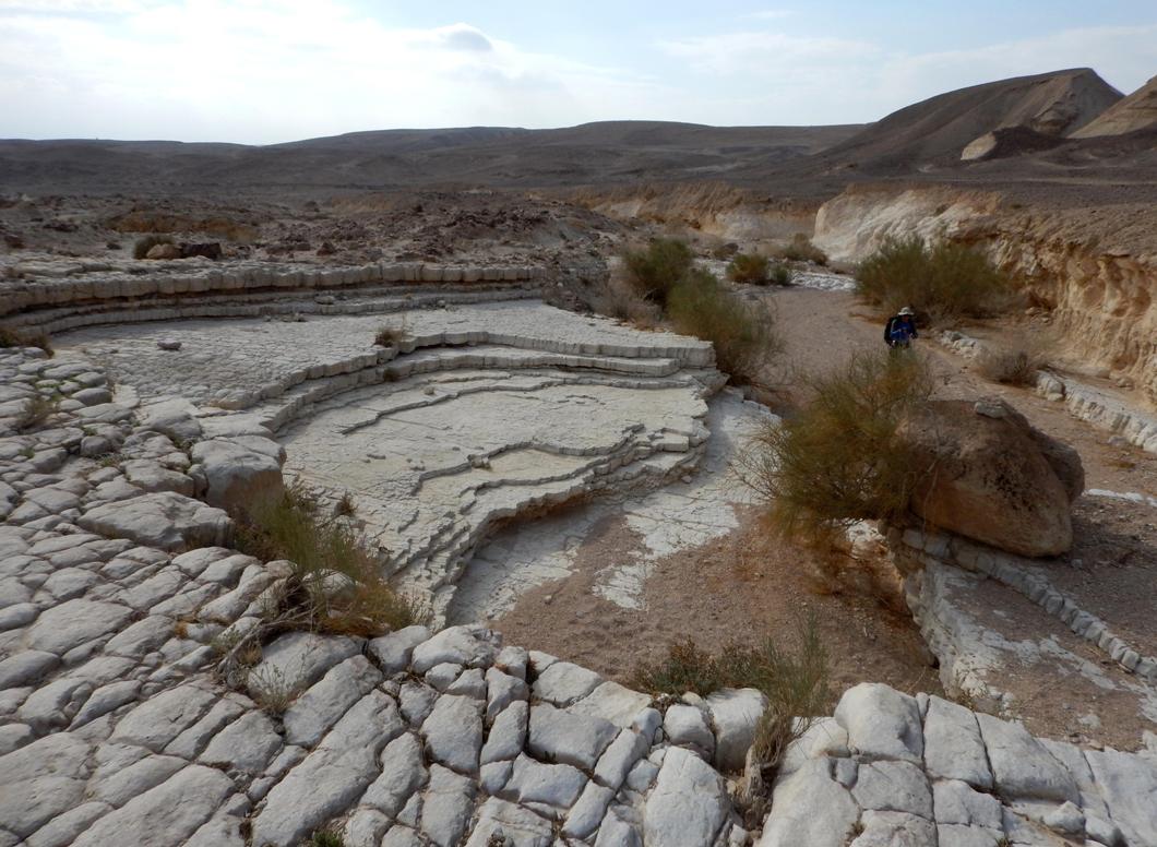
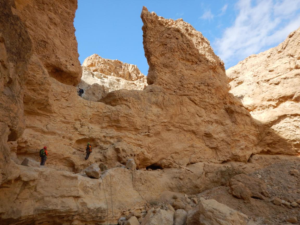
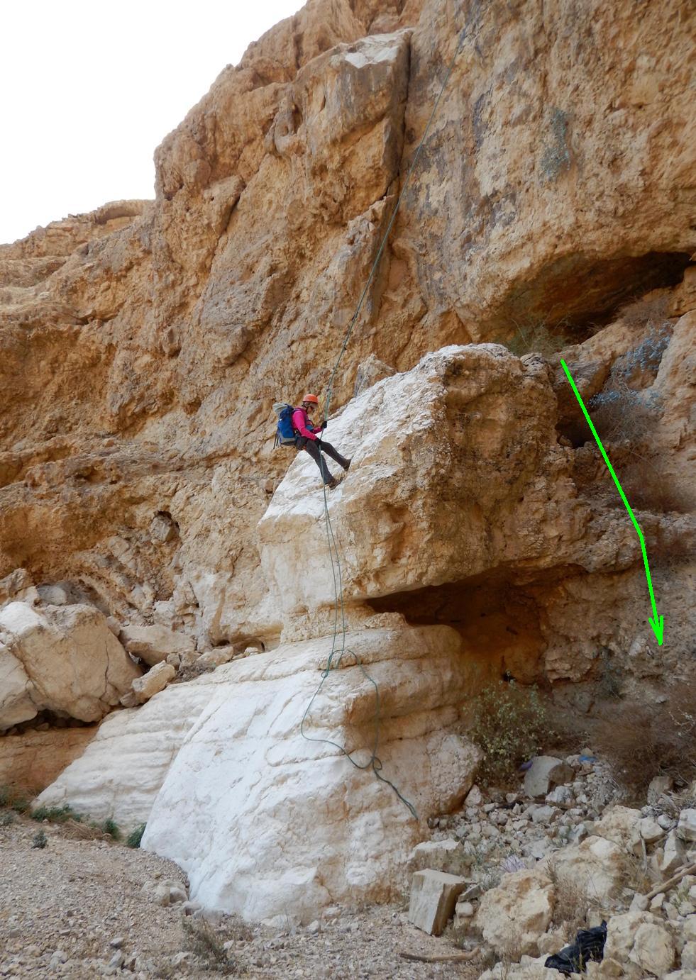
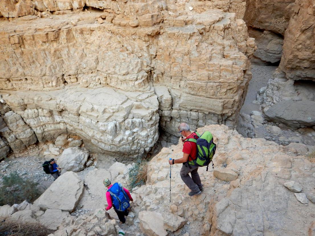
The next rappelling point is 250m down
the canyon. Two big (5-6m high) U-shaped drops can be bypassed on the left
side.
When approaching the next rappelling
spot, keep left and don’t enter into the narrow main channel.
|
|
Walking to the next rappelling point (view back on the
2nd dry fall) |
|
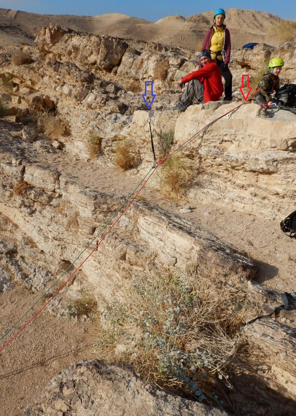
Approaching the 3rd rappelling station (blue arrow) |
|
|
|

3.
15m (first 7m very gentle, then steeper)
Down climbing is possible but it is not
easy. Be careful!
At the moment, there were 2 excellent
bolts suitable to pull rope through.*
|
|
The 3rd dry fall rappelling station |
|
The 3rd dry fall |
|
|
|
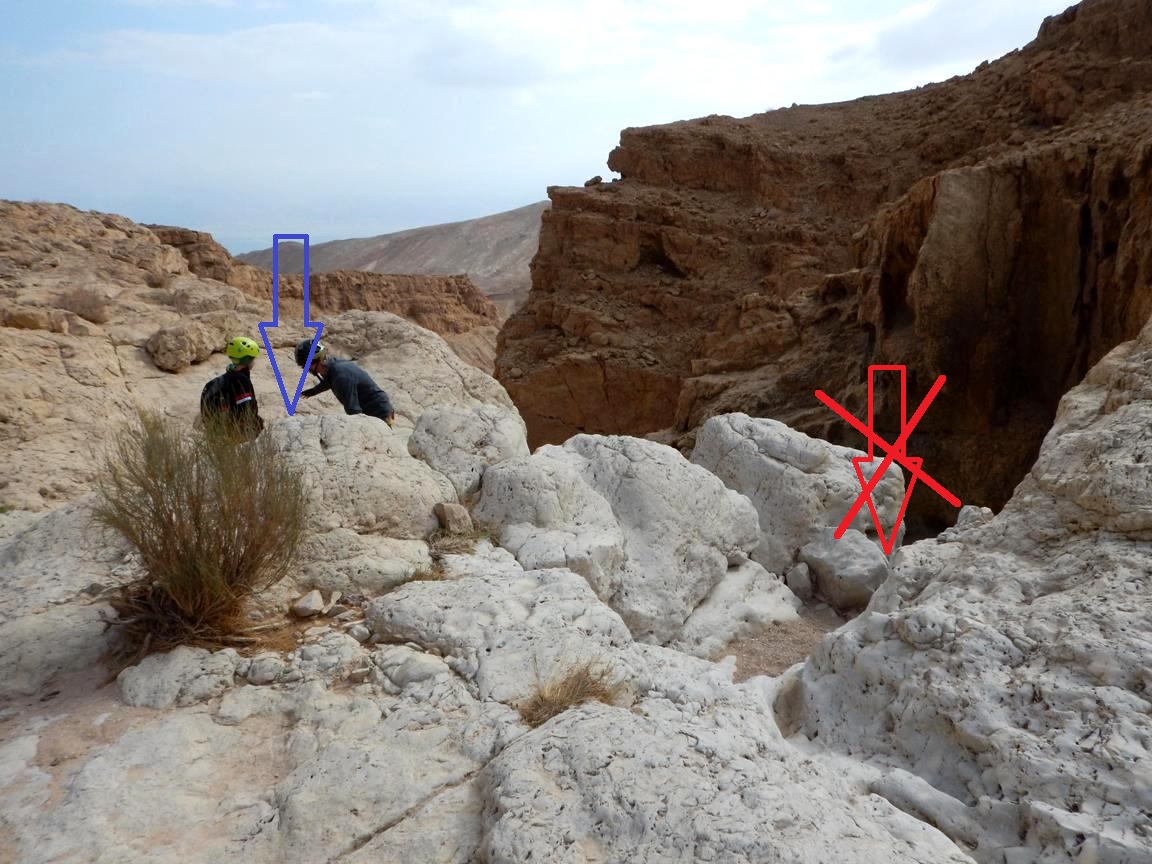
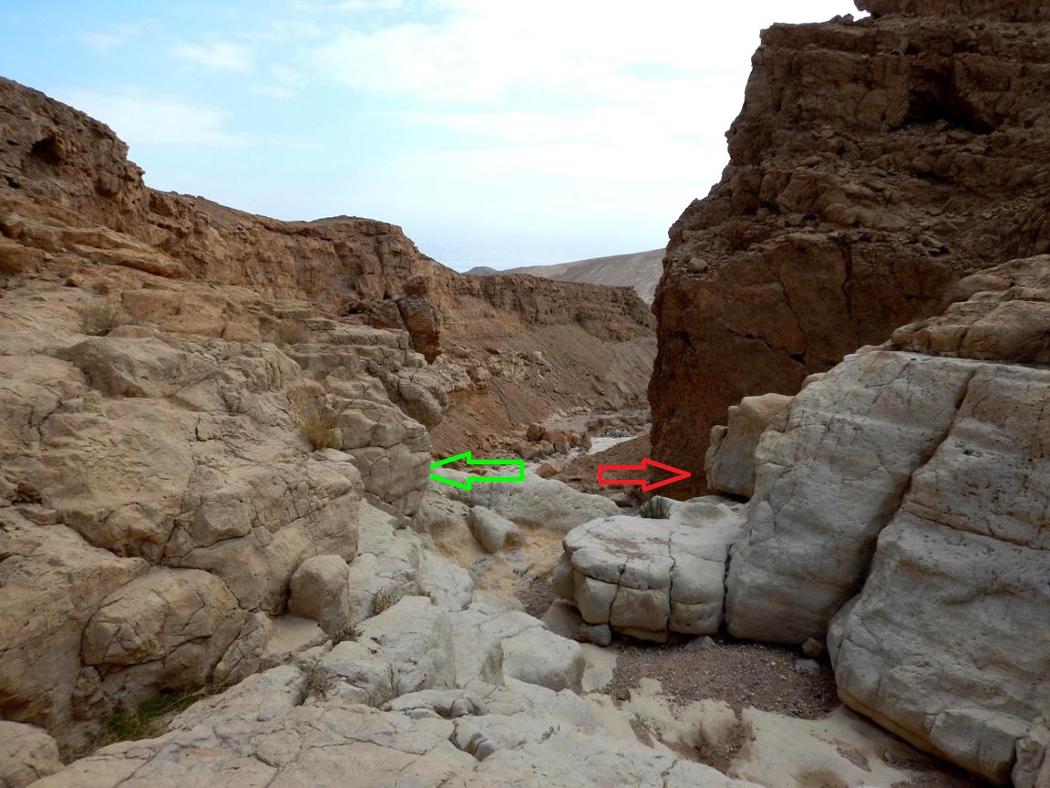
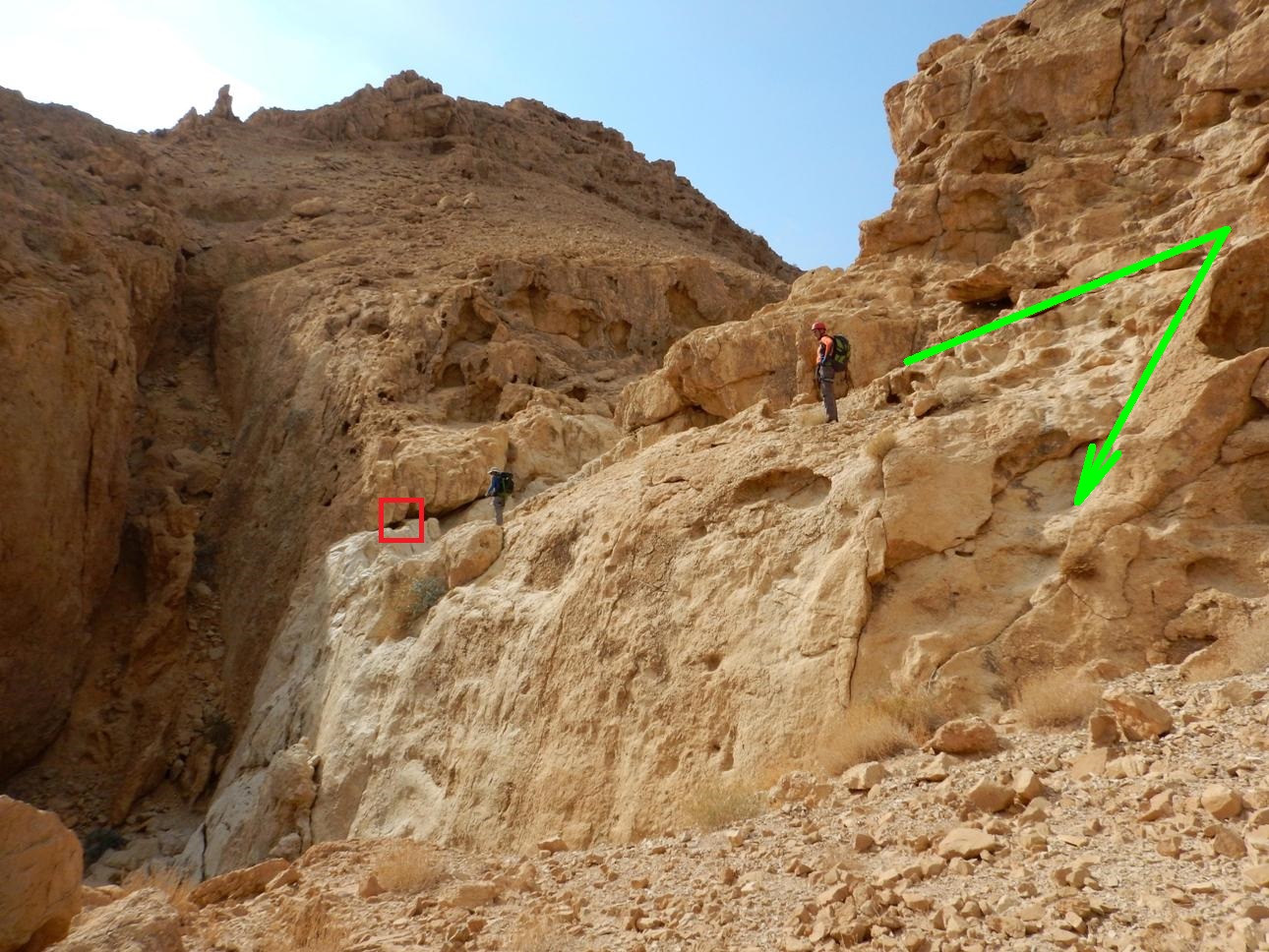
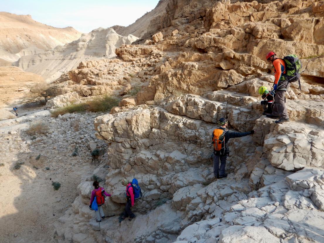
20m further we came to
another dry fall some 15-20m high. On the right we found a rappelling station (red
arrow and red frames on the photos), but I would not recommend to use it as it
looks not too much reliable. Instead you can traverse left along the edge
(green arrow) and to climb down to a rocky ground. Being here cross the ground
keeping right and take another short climb down just along the wall to the main
channel. The forth rappelling station can be found on the right wall of the
channel.
|
|
Red arrow – to a rappelling station; |
|
The not recommended rappelling station |
|
Traversing to the left |
|
|
|
|
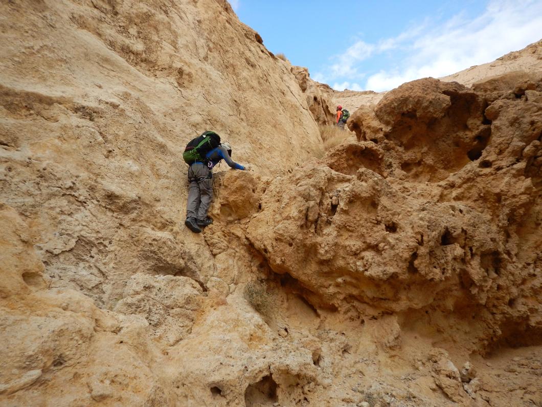
The traverse and the first climb down |
|
The second climb down |
|
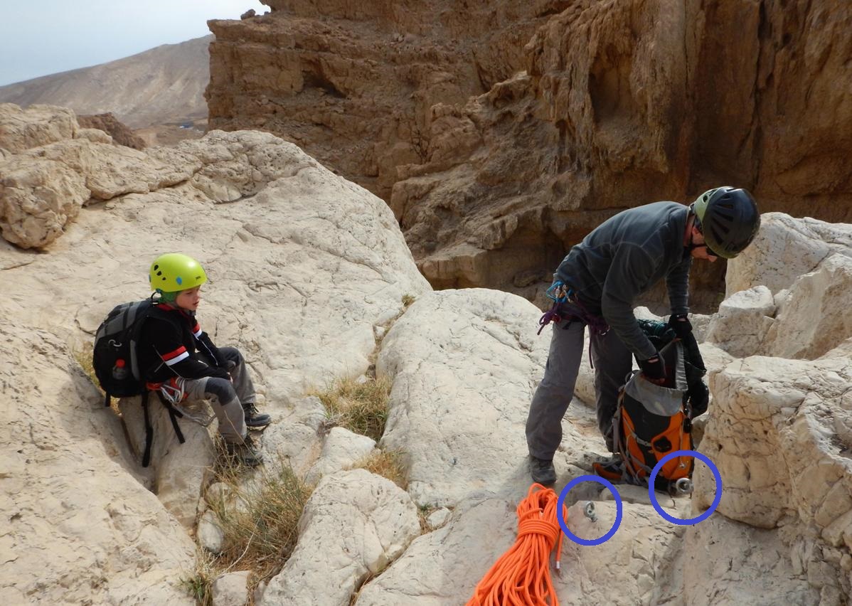
The 4th rappelling station |
|
|
4.
21m (5-6m sloped, then 6-7m vertical to a wide ledge, then 5-6m
vertical). It is possible to climb down from the ledge on the left side.
At the moment, one bolt only (suitable to
pull rope through) was found on the right wall. *
|
|
The 4th dry fall rappelling station |
|
The 4th dry fall |
|
The 4th dry fall |
|
|
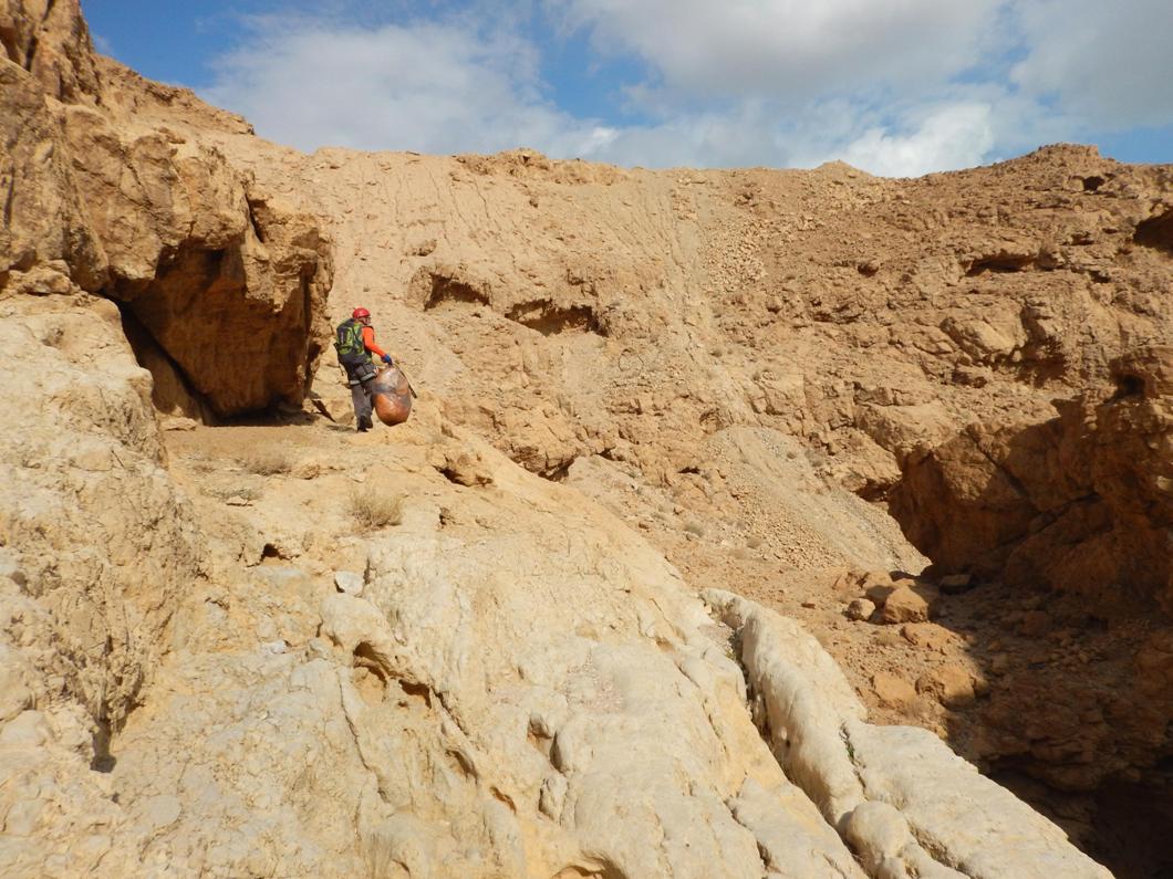
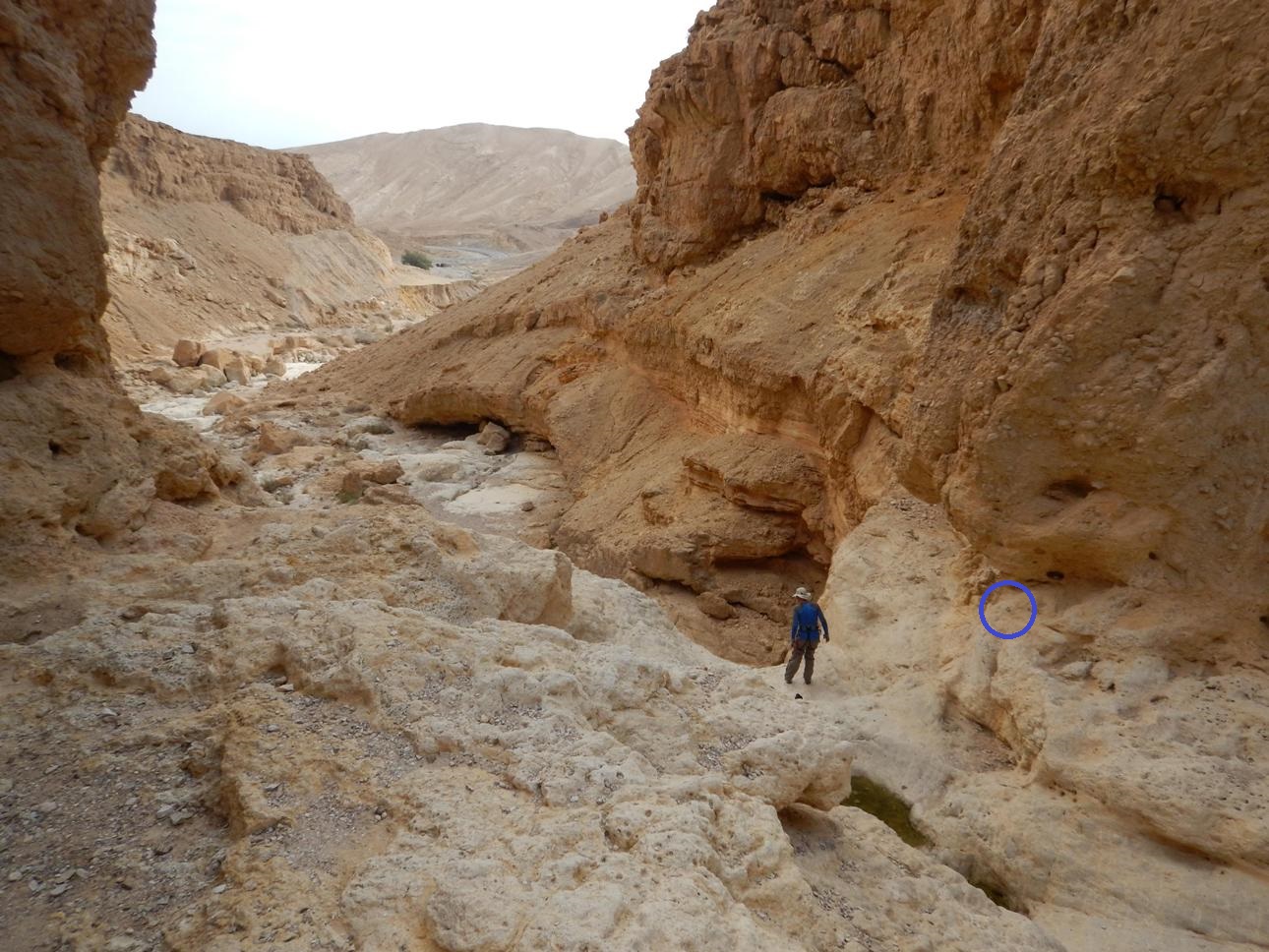
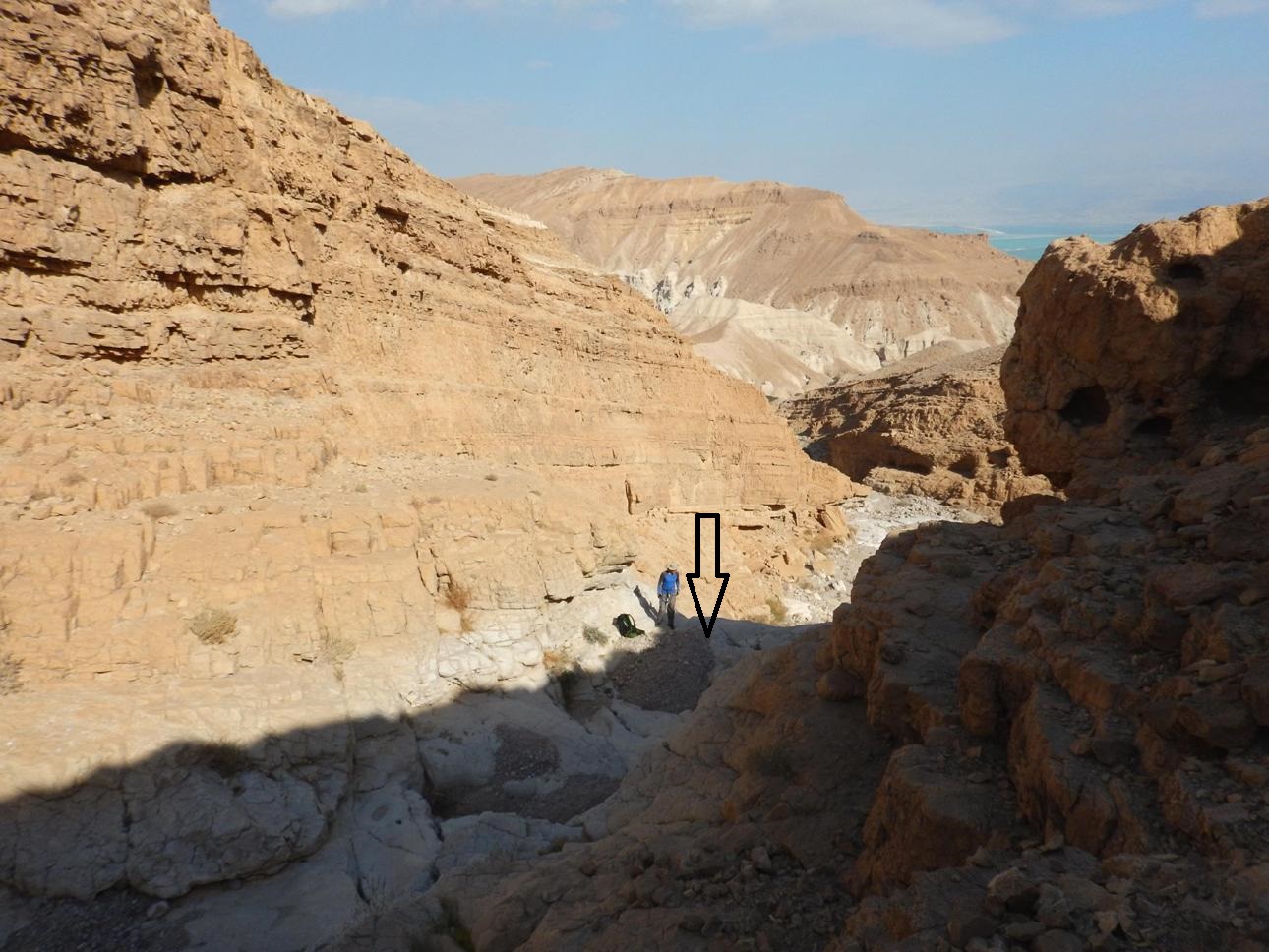
From the
base of this dry fall walk another 500m to the road 31 (point 3 on the map). Here you can either exit from the route
or cross under the road and continue for the full joy as we did.
|
|
Coming to the road 31 |
|
|
|
|
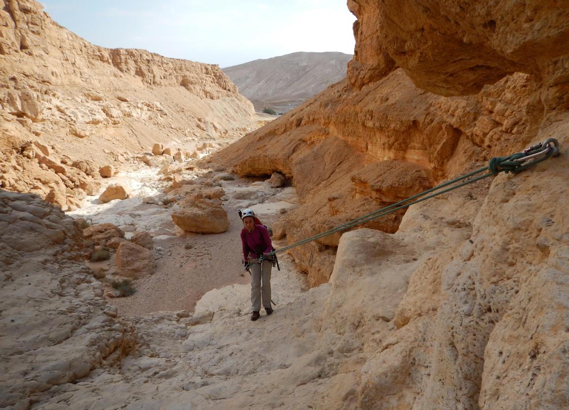
After crossing the road walk down the
canyon another 500m till a dry fall which should be bypassed on the right. Look
for cairns. 100m long traverse along ledges will bring you to the 5th (and
last) rappelling spot.
|
|
Start of the long bypass |
|
Approaching the 5th rappelling station |
|
|
|

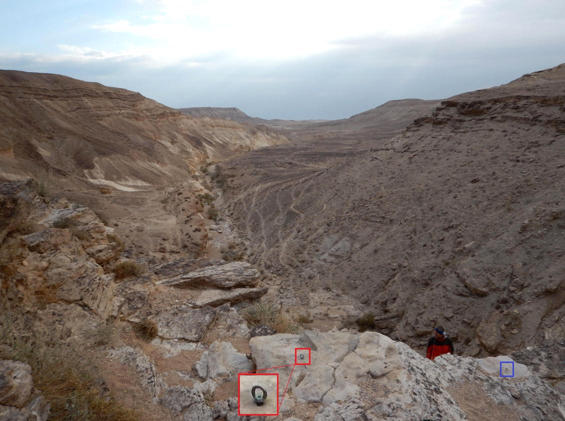
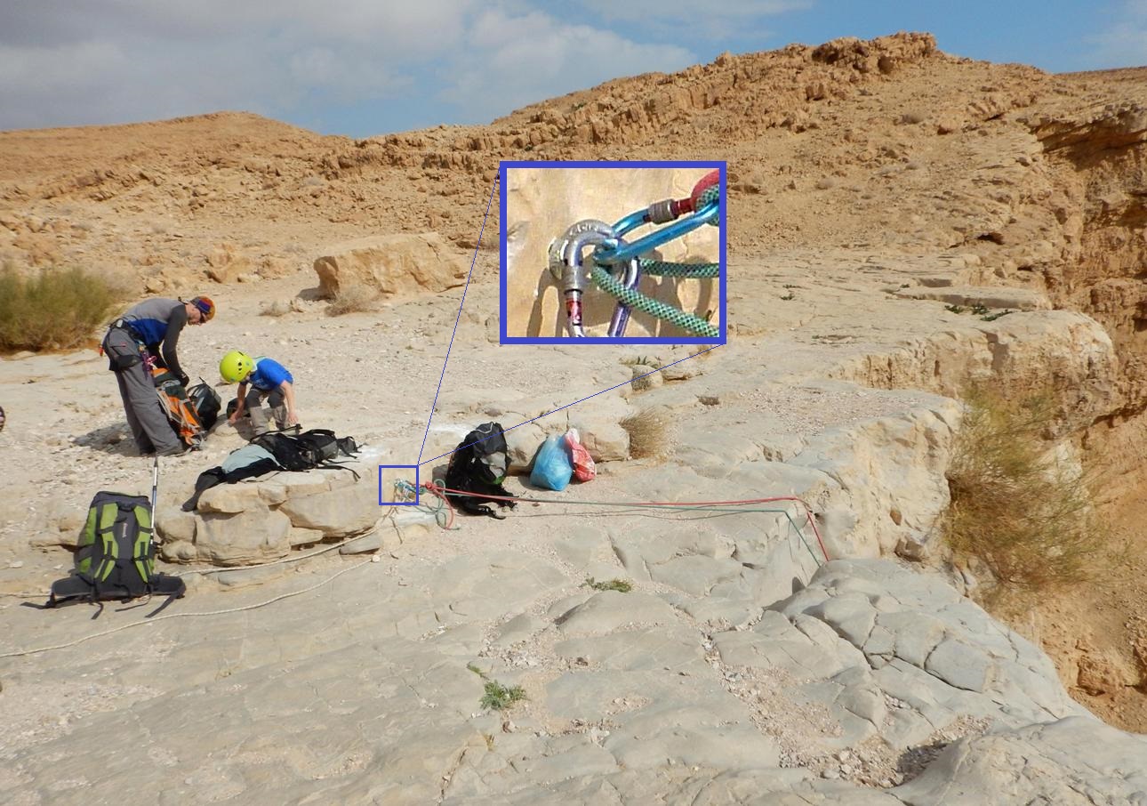
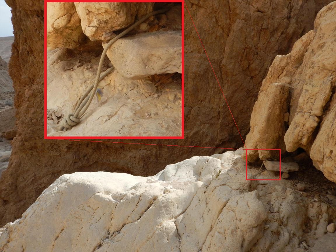
5.
Max. length: 30m if measured from the natural
through holes found about 6m from the edge and till the very ground.
(6m to the edge, then 7m vertical plus 7m overhang to a big rocky
"pedestal", then 8-10m to the ground).
It is possible to climb down from the
"pedestal" on the left side (green arrow on the 3rd photo), but we
came here to rappel, is not it?..
At the moment, there was no ready for use bolts but some other options are
available. We used a couple of natural through holes found about 6m from the
edge as the main anchor (red frames). A reliable artificially drilled through
hole can be found on the right side (blue frames). We used it to backup the
main anchor. *
|
|
The 5th dry fall rappelling station |
|
The 5th dry fall |
|
The 5th dry fall. Green arrow mark the |
|
|
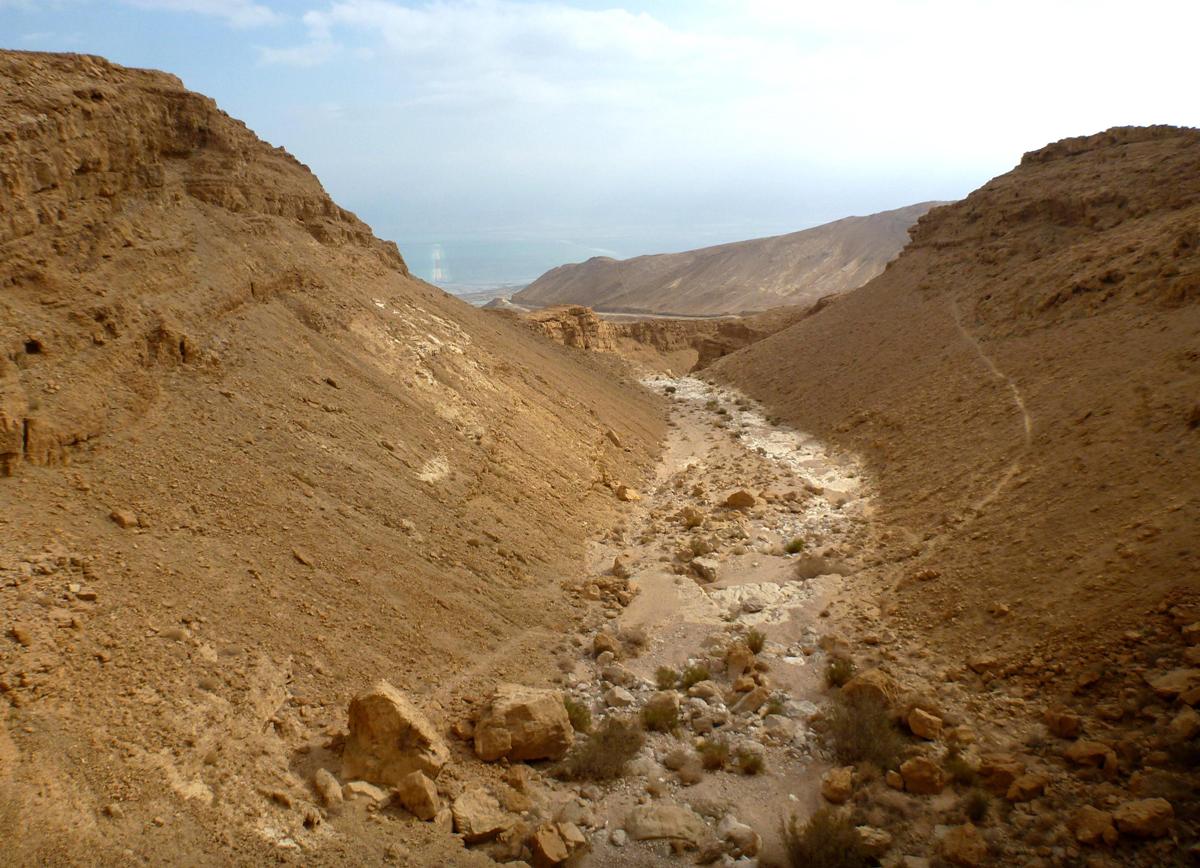
From the foot of the
wall walk down the canyon for about 300m till a dry fall. Three consequent long bypasses start here: the first
and the second - on the right side and the third - on the left side:
|
|
Start of the first right bypass |
|
End of the second right bypass |
|
Start of the left bypass |
|
|

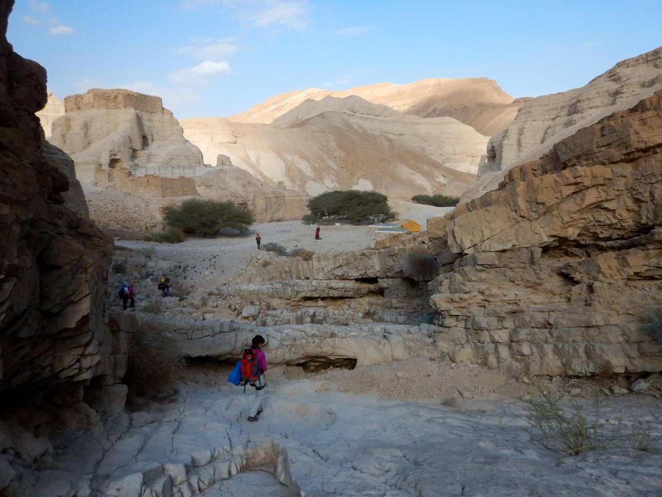
About 200m after the last bypass you will
reach an inflow point of nahal Halamish
into nahal Zohar. On your
left rises upwards a fortress. This is Metsad Zohar - an ancient Roman building which is worth exploring
for a ten minutes.
From here follow the "green" trail which runs along the bed of nahal Zoar, pass through a short
narrow wonderful canyon, walk under imposing walls at the exit from the canyon,
pass under the high bridge of road 90 and walk across last uninspiring flat
patch to the "Delek" gas station (
|
|
Coming to Metsad Zohar |
|
Descending into the canyon of nahal
Zohar |
|
Nahal Zohar |
|
|
***** - The only one of its kind. A "must
do" trip!
****
- Very interesting, highly recommended!
***
- Pretty nice route.
** - Inexpressive
one.
* - Do it if you have nothing to
do...